
Watauga Lake facts — elevation, depth, surface area, history
The factual basics of Watauga Lake — elevation, depth, surface area, the dam, the drowned town, and the geology that made the lake what it is.
By Bill · May 25, 2026
On this page
If you’re researching Watauga Lake for a trip — or just want to know how this lake works — here are the factual basics in one place. Most of this is buried inside other articles about fishing or hiking or weather; this is the reference page.
The numbers
Elevation: 1,975 feet above sea level at full pool. The lake operates between approximately 1,955 feet (winter pool) and 1,975 feet (summer pool). TVA draws the lake down in late fall by about 20 vertical feet for flood storage capacity through winter, then refills it for the recreation season.
Maximum depth: Approximately 265 feet near the dam. The original river channel ran here before the lake filled.
Average depth: Around 95 feet. The lake gets shallower as you move away from the dam toward the upper end (toward Butler).
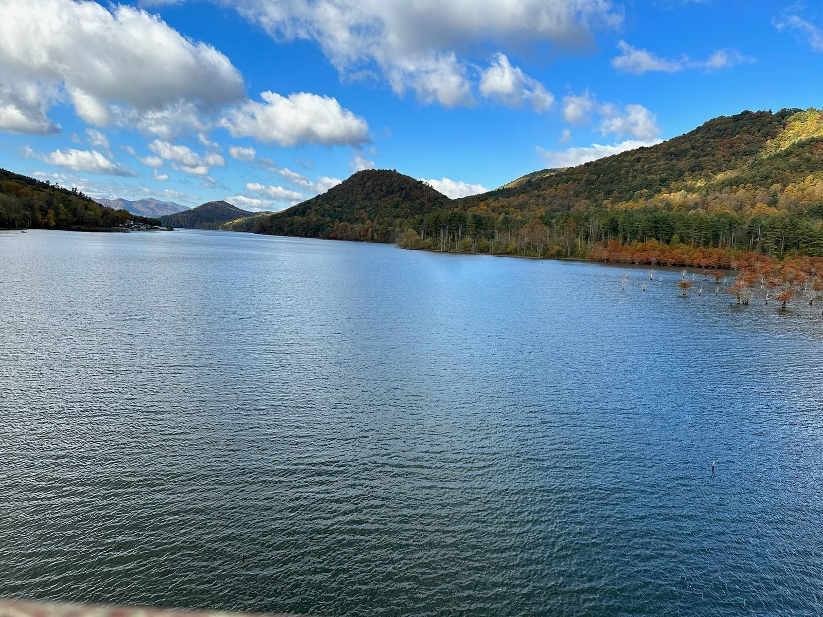
Surface area: 6,430 acres at full pool. About 10 square miles. Visible from satellite. Roughly 16 miles long from east (dam) to west (upper end). Shoreline length is approximately 105 miles, mostly undeveloped because most of it is Cherokee National Forest land that TVA can’t sell.
Volume: About 661,000 acre-feet at full pool. That’s roughly 215 billion gallons of water — enough to supply the city of Knoxville for several years if drinking water were the use.
Watershed: The lake drains about 469 square miles of the Watauga River basin, which flows out of the Roan Mountain and Pond Mountain highlands.
The dam
Watauga Dam is one of the iconic earth-and-rockfill dams in the TVA system.
- Height: 331 feet (one of the tallest in TVA)
- Length: about 925 feet across the top
- Type: Earth and rockfill — built from material excavated from the reservoir bed and surrounding hills, not a concrete dam
- Generation capacity: 50 MW (relatively small for TVA — Watauga was built primarily for flood control, with power generation as a secondary purpose)
- Year completed: 1948 (construction began 1942, paused for WWII, resumed 1946)
The Appalachian Trail walks across the top of the dam. It’s one of only a handful of points on the AT where the trail crosses a working dam. See our trail entry on the dam crossing and the section-hiker guide for the hiker’s perspective.
Below Watauga Dam is Wilbur Dam — a much smaller dam (76 feet high) that creates Wilbur Lake, a small reregulation reservoir. Wilbur Dam was actually built first (1912), making it one of the oldest TVA-era dams in the system. The two-dam structure is unusual and is part of why the tailwater fishery below Wilbur Dam runs cold year-round (see our fly fishing guide).
Why the lake exists
The headline reason: flood control.
In August 1940, a stalled tropical system dropped enormous rainfall over east Tennessee and western North Carolina. The Watauga and Holston Rivers crested 15-20 feet above flood stage. Towns downstream — Bristol, Kingsport, Knoxville — sustained millions of dollars in damage. The flood killed at least 60 people across the region.
TVA had been mapping the upper Tennessee valley for potential reservoirs throughout the late 1930s. The 1940 flood made the case undeniable. Watauga Dam construction was authorized in 1941 and began in 1942. World War II steel rationing and labor shortages paused work from 1943-1946. The dam was completed and the lake filled in 1948-1949.
Secondary purposes the lake serves: hydroelectric power generation, water supply (though minor here), and recreation.
The drowned town
The lake bed was farmland and a small town called Butler.
Butler was settled in the 1820s, named for a local family. By the 1940s it had about 750 residents, a school, several churches, a mill, and the small businesses you’d expect of a county-seat town in rural east Tennessee. The Watauga River ran through the middle of it.
When TVA announced the dam project, Butler was inside the eventual lake footprint. The federal government bought out the residents — 95+ family farms and the town center — through a combination of negotiated sales and eminent domain proceedings. About 750 graves were relocated to the new town of “New Butler” on higher ground above the eventual waterline.
The cypress trees you can still see standing in the lake near Pioneer Landing and along the upper-lake shoreline are remnants of Old Butler. They were planted by farmers as field-edge trees and survived being submerged because cypresses can live in standing water. Their bare gray trunks above the lake are one of the most haunting visual signatures of Watauga.
Old Crow Medicine Show’s song “Half Mile Down” is about Old Butler. It’s been covered by several other artists and is the most-listened-to musical reference to the place. The Butler Museum (in New Butler, the town that moved up the hill) keeps the actual artifacts and photographs from before the flooding. We have a longer piece on the town’s history.
Geology — how the valley got here
The Watauga River cuts through the Blue Ridge province of the southern Appalachians. The mountains around the lake are mostly gneiss and schist — metamorphic rocks more than a billion years old. The deep river valley that became the lake was carved over the last ~50 million years as the Watauga River cut down through softer rock layers.
The surrounding mountains rise sharply because the Appalachian fold-and-thrust structure pushed harder, more resistant rock upward, while softer rock weathered away faster. Roan Mountain (6,285 feet, about 20 miles southwest) is the local high point. The Iron Mountain ridge on the south side of the lake is also a major structural feature.
For practical purposes: the lake is a flooded river valley with steep mountain slopes on three sides, making most of the shoreline undevelopable. The surrounding land is roughly 80% federal (Cherokee National Forest) and 20% private. That’s part of why most of the shoreline looks undeveloped from a boat.
Water quality
Watauga Lake water quality is generally good by TVA reservoir standards.
- Cold mountain inflow keeps the lake cooler than most southeast reservoirs.
- The depth (265 feet) creates strong thermal stratification — surface water can be 80°F in August while deep water stays at 50°F.
- Visibility (Secchi disk) typically 3-6 meters in summer, more in winter.
- No agricultural runoff problems of significance — the watershed is mostly forested.
- Some seasonal algae blooms in late summer in the upper-lake coves, but no chronic toxic blooms.
For swimmers, the water is genuinely clean. See our safe-for-swimming piece for the full discussion. For paddlers, see kayak launches.
For anglers, the cold-water layer supports a year-round trout population in addition to the warm-water bass fishery. See fishing guide for that side.
How the lake compares to other reservoirs
| Watauga | Norris | Boone | Smith Mountain | |
|---|---|---|---|---|
| Surface area | 6,430 ac | 33,840 ac | 4,310 ac | 20,260 ac |
| Max depth | 265 ft | 200 ft | 132 ft | 250 ft |
| Length | 16 mi | 73 mi | 17 mi | 40 mi |
| Year filled | 1949 | 1936 | 1953 | 1966 |
| Shoreline development | Low | Moderate | High | High |
Watauga is on the smaller side of TVA reservoirs but deeper than most. The combination of depth + mountain setting + low development gives it a different character than Norris (much bigger and busier) or Boone (smaller but heavily developed). See our Watauga vs Norris and Watauga vs Smith Mountain pieces for the comparison reads.
Practical implications
A few things the facts tell you about visiting:
The depth means cold water year-round. Even in August, the surface is 80°F but the deep water is 50°F. Swimming is fine; jumping into deep water is a shock. See water temp piece.
The 20-foot annual drawdown matters for boating. Coves that are wadable in July are dry mud in February. Boat ramps that work all summer can be unusable when water is at winter pool — check the TVA water level reports before launching in winter.
The mountainous shoreline means few public beaches. Most of the shoreline is undeveloped national forest and unwalkable. The developed swim beaches (Shook Branch, Watauga Point) are the practical access points.
The lake’s elevation (~2,000 feet) makes summer cooler than the lowlands. It’s typically 5-10°F cooler than Knoxville or Bristol on any given summer day.
The cold tailwater below the dam is a separate ecosystem. The river below Wilbur Dam is trout water — completely different from the lake itself.
Where to find more
- TVA Lake Info — current water levels, generation schedules, lake maps: tva.gov
- Tennessee Wildlife Resources Agency (TWRA) — fishing regulations, stocking reports: tn.gov/twra
- Cherokee National Forest — trail maps, dispersed camping info, regulations: fs.usda.gov/cherokee
- The Butler Museum — Old Butler history and artifacts (in New Butler, TN)
- The historical record — the East Tennessee State University archives have substantial collections on the Watauga Dam construction era
For the broader experience of visiting the lake, our main lake guide covers the destination perspective. For where to stay, the property page has our specifics, and where to stay covers the broader options.
Want to stay at the lake?
Our modern two-bedroom townhouse has sweeping lake and mountain views, a jet tub, and a gas fire pit on the back porch.
Common questions
What's the elevation of Watauga Lake?
How deep is Watauga Lake?
How large is Watauga Lake?
When was Watauga Dam built?
Why was Old Butler flooded?
More like this
Keep reading
Old Butler — the town under Watauga Lake
The story of Old Butler, Tennessee, the only incorporated town the TVA ever flooded, and the familie
Watauga Lake water temperature by month, with swim and fishing windows
Surface water temperatures at Watauga Lake by month, when the swim season actually starts and ends,
Watauga Lake weather and climate, with what to pack by season
Watauga Lake climate facts: elevation 1,959 ft, monthly temps, precipitation, snowfall, microclimate
Cherokee National Forest from Watauga Lake
Watauga Lake sits inside the Cherokee National Forest, which is most of why the shoreline is undeveloped and the water is so clear.