
Carter and Johnson Counties, Tennessee
Watauga Lake — the dam, the old town under it, and what to do once you're here
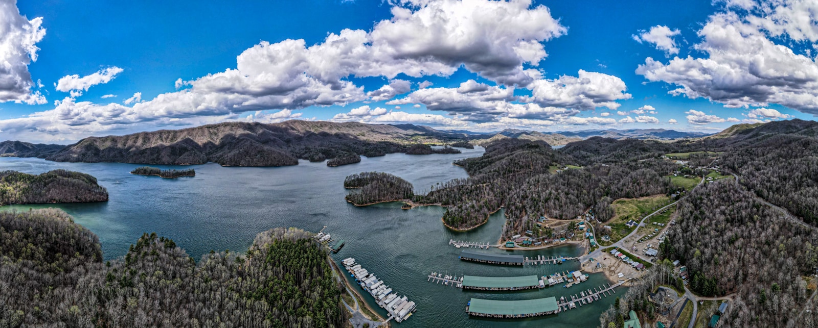
A 6,430-acre reservoir tucked into the Cherokee National Forest. Sixteen miles long. Two rivers feeding it. An entire town under one end of it, since 1948.
Watauga Lake sits in the high northeast corner of Tennessee, where the state runs into North Carolina and Virginia. It's not a famous lake. It doesn't show up on most "best lakes in America" listicles. But locals will tell you that's part of the point — Norris Lake gets the houseboaters, Norfork gets the bass tournaments, and Watauga gets to stay relatively quiet.
The lake is shaped like a long, wandering Y, with the Watauga River feeding in from the southeast and the Elk River from the north. Most of the shoreline is inside the Cherokee National Forest, which is the practical reason the lake doesn't look like every other reservoir in the South. There aren't houses on most of it. There aren't condos. There's just water and trees and the occasional public access point, and that's almost the whole story.
This guide is the long version. If you only want the short version: come in October if you like color, come in July if you like the water, come in February if you like quiet. Stay somewhere with a view. Eat at Captain's Table at least once. The rest of this page is detail.
The lake in twelve numbers
Quick facts
- Surface area
- 6,430 acres
- Shoreline
- 104.9 miles
- Length
- 16.3 miles
- Elevation (full pool)
- 1,959 feet
- Maximum depth
- 265 feet
- Average depth
- 52.5 feet
- Fed by
- Watauga River, Elk River
- Counties
- Carter, Johnson
- Dam completed
- December 1948
- Dam height
- 331 feet
- National forest
- Cherokee
Sources: Wikipedia (Watauga Lake), USDA Forest Service Cherokee National Forest, Tennessee Valley Authority. Verified May 2026.
How the lake got here, and why there's a town under it
Before 1948, the Watauga River ran through a long, narrow valley with the town of Butler in its bottom. Butler had been there since the 1820s — a small farming and timber town with a few stores, a school, and a courthouse. The valley was fertile because rivers tend to make valleys fertile.
The Tennessee Valley Authority started building Watauga Dam in 1942, on a site about three miles downstream of the old town. Construction paused for World War II between 1942 and 1946, then resumed when the war ended. The dam closed on December 1, 1948. The reservoir began to fill.
The TVA had bought out the residents of old Butler in the years before the dam closed. The town was relocated to higher ground — what's now the new Butler, just up the road. The old town went under the water. Buildings were demolished or moved; foundations and a few stubborn structures stayed put and were eventually covered by the lake. Locals will tell you that in low-water years you can still see the top of the old bell tower if you know where to look — that one's hard to verify, and the lake's water level doesn't usually drop low enough to test it.
The story of old Butler is a real part of the lake's identity. Old Crow Medicine Show, who came up in nearby Boone, wrote a song called "Half Mile Down" about it. The Butler Museum (in the new Butler, fifteen minutes from the lake) collects photographs, household objects, and oral histories from the families who lost the town. It's small. It's worth an hour if you want to understand what you're looking at when you look at the water.
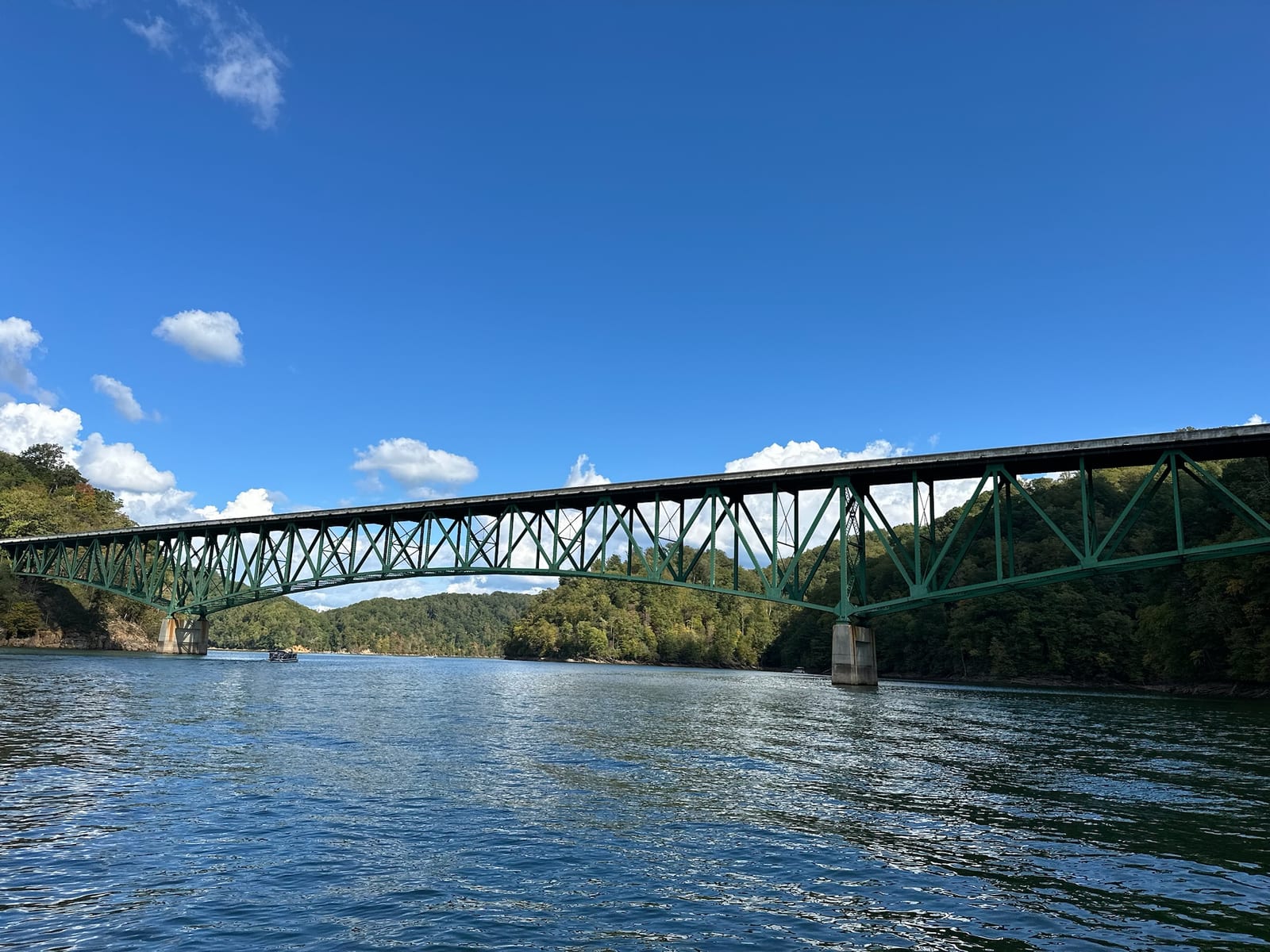
Watauga Dam itself is 331 feet high and 925 feet long — among the tallest dams the TVA built. It produces hydroelectric power and provides flood control for the Watauga River basin. The Appalachian Trail crosses on top of it, which is one of the more dramatic foot crossings on the entire 2,200-mile trail.
What "Watauga" means
Watauga is a Cherokee word. The most commonly cited translation is "beautiful waters" — *wata* (water) plus *uga* (an intensifier or descriptor). You'll see it printed on every brochure in the region.
Scholars disagree about the etymology. Other proposed translations include "broken waters" (from a Creek root), "village of many springs," and "the land beyond." A 2000 paper by Allan Scherlen of Appalachian State University reviewed the various theories and concluded the original meaning is partly lost — the word survived but the precise context didn't. If you want certainty, you won't find it.
The safe phrasing, the one we use when guests ask: "Watauga" is most often translated from Cherokee as "beautiful waters," though scholars disagree on the original meaning. That covers the popular usage without claiming more than the historical record supports.
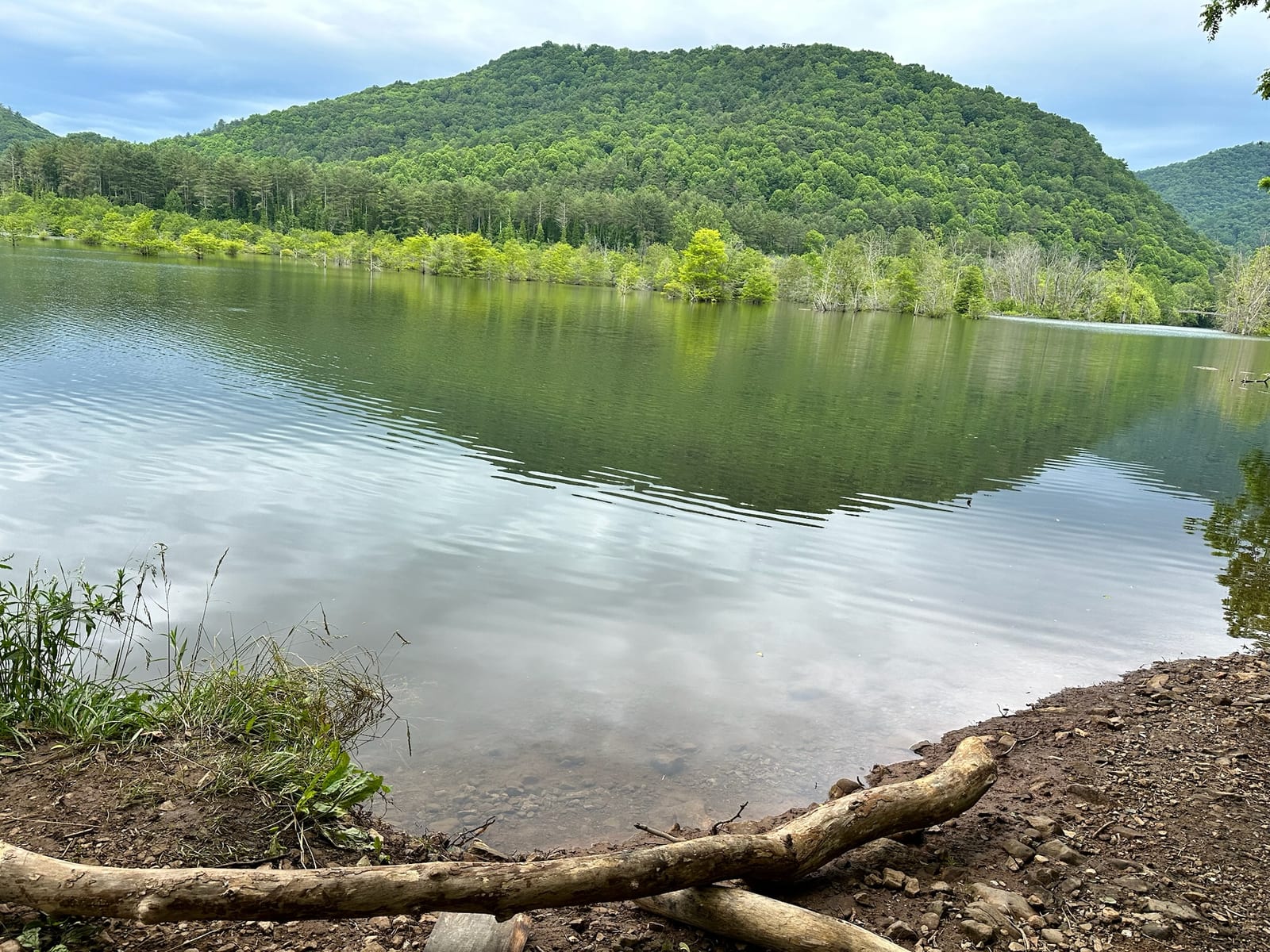
The water and the forest
Why the lake stays clear
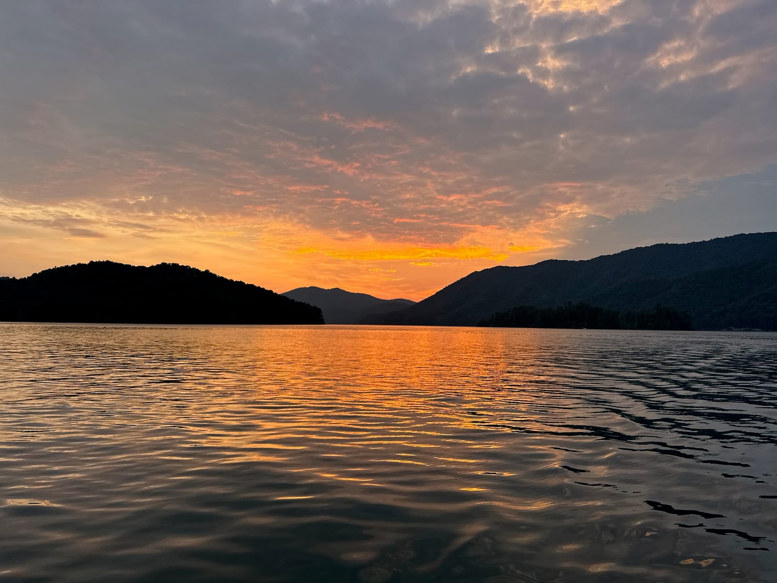
Watauga Lake's water is unusually clear for a reservoir in the southeastern United States. There are two practical reasons for this. The first is depth — at 265 feet at its deepest, the lake holds enough cold water to support cold-water species like rainbow trout year-round, and cold water carries less algae. The second is land use. Most of the shoreline is inside the Cherokee National Forest, which means it's not being developed, fertilized, or drained into.
You'll see the claim that Watauga is "the third-cleanest lake in America" repeated on tourism websites. We've tried to verify it and we can't — there's no USGS, EPA, or peer-reviewed ranking that supports it. It seems to come from a single brochure quote that's been copied for a decade. The lake is genuinely clear; you can see fish in 10 feet of water on a still morning. We'd rather tell you that than make up a ranking.
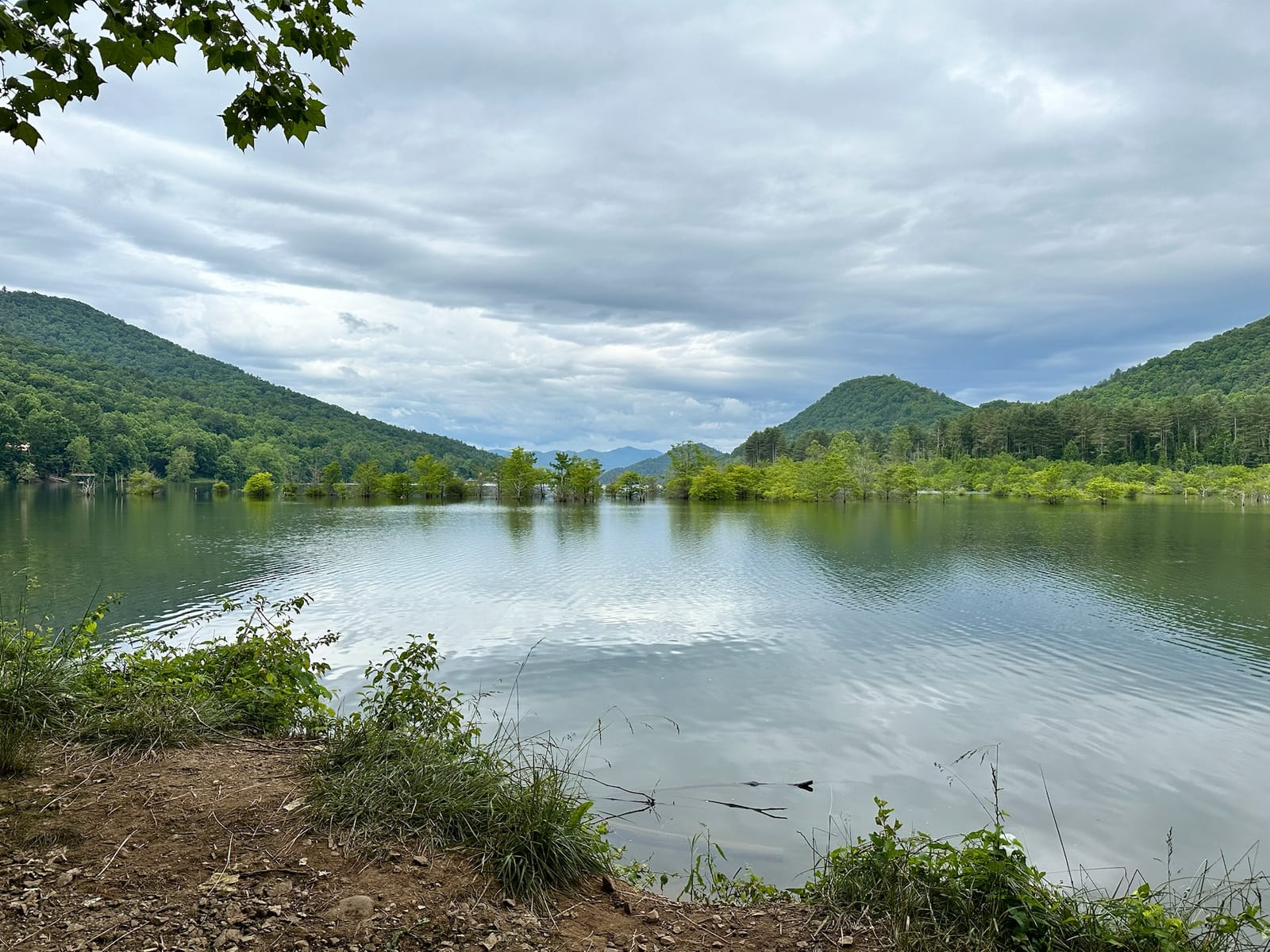
The lake's water level varies by about nine feet over the course of a normal year. TVA draws the level down in winter to manage flood capacity, and refills it in spring. That means the shoreline in November looks meaningfully different from the shoreline in June. Plan accordingly if you have a boat you need to launch.
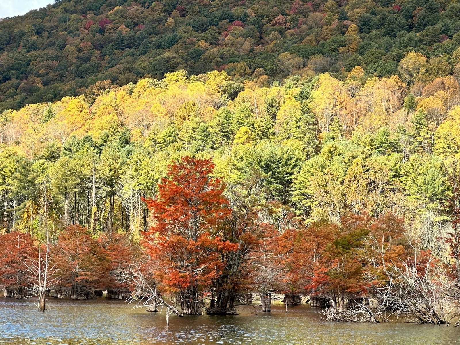
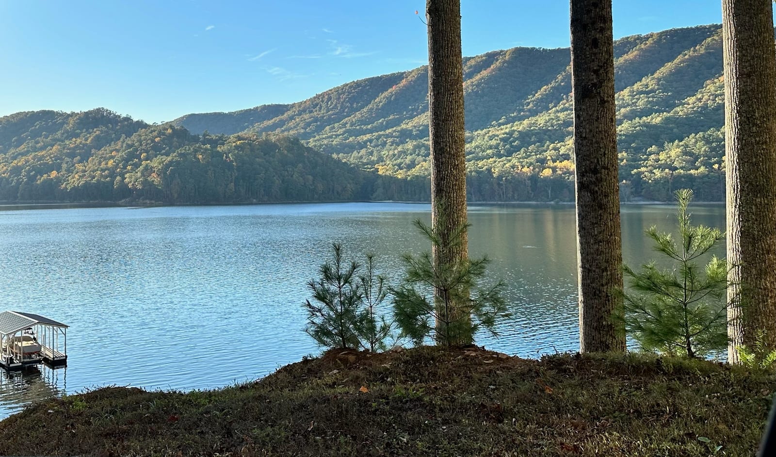
The lake, season to season
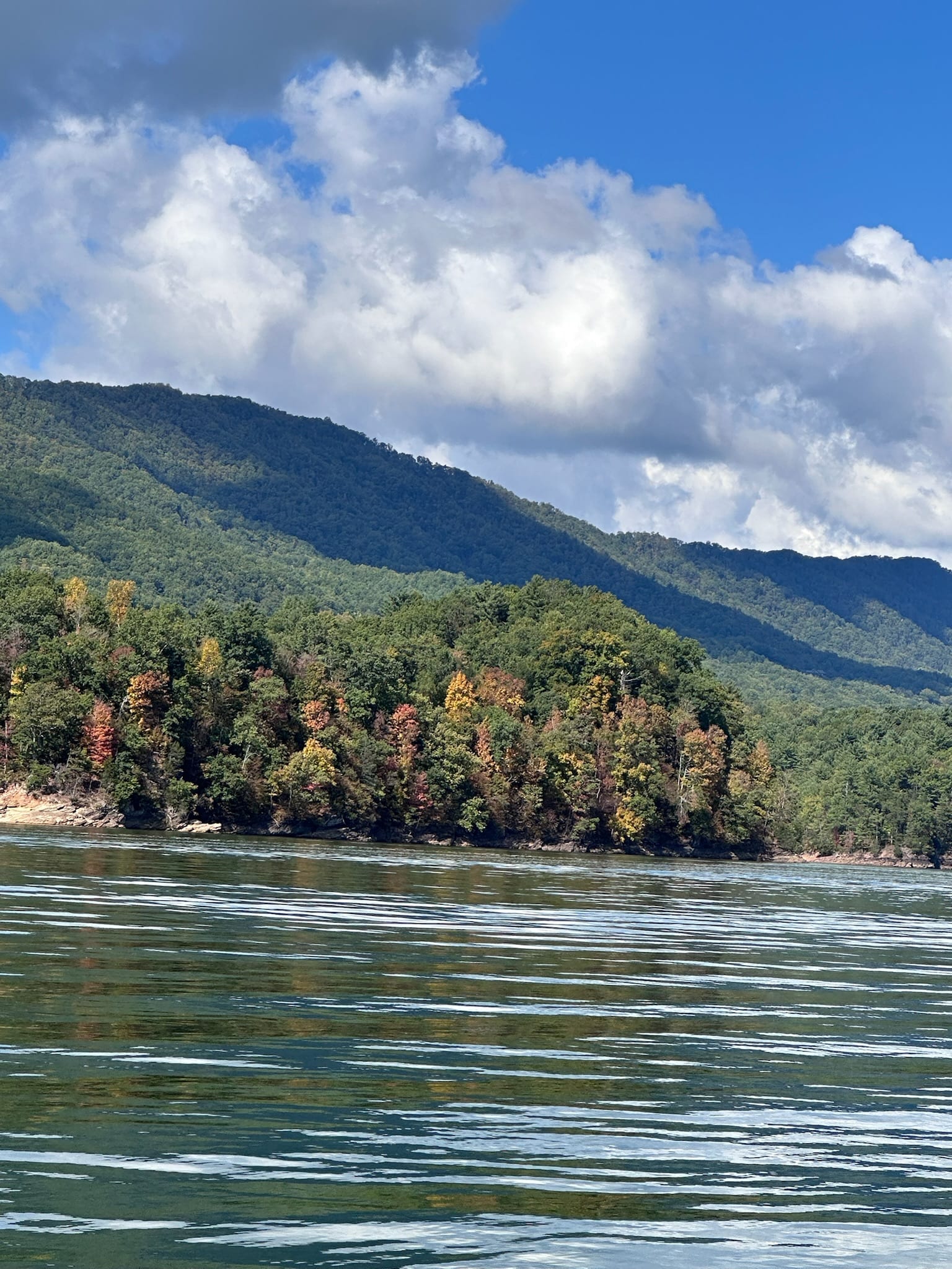
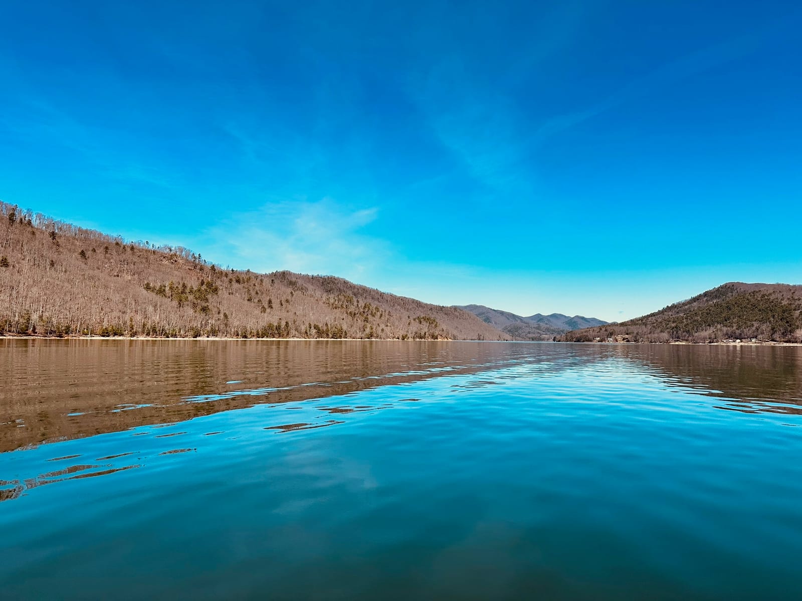
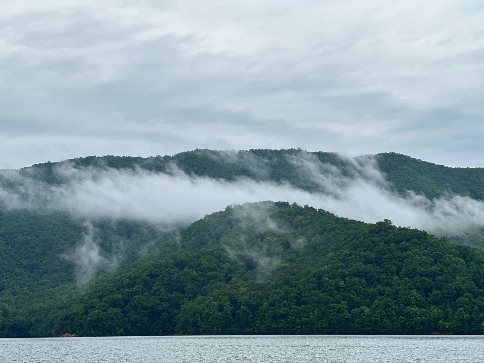
What 6,430 acres in a national forest looks like
Different weeks, different months, different light. Same lake.
Wildlife
The undeveloped shoreline makes the lake a serious wildlife habitat.
Bald eagles fish the lake year-round. The southern shoreline near the dam is a regular nesting area; if you're out on a boat in the early morning, you'll see eagles diving for fish about as often as you see other boats. White-tailed deer cross the property and the woods constantly. Black bears live in the surrounding national forest — they're not aggressive but they're there, and you should not leave food in your car at trailheads.
At dusk in summer, loons call across the water. The sound carries for half a mile and people who've never heard a loon in person tend to stop talking when they hear one for the first time. The lake also supports osprey, herons, kingfishers, and a variety of warblers and songbirds. Birders consider Watauga Lake one of the better stops in northeast Tennessee.
Underwater: largemouth and smallmouth bass, walleye, rainbow trout (stocked by TWRA), brown trout, crappie, bluegill, and the occasional muskie. The combination of warm-water and cold-water species in one reservoir is unusual and is what makes the fishery interesting. (See our fishing guide for what's biting when.)
Getting on the water
Marinas and public launches
Watauga Lake public boat launch
Free, paved, on the south side of the lake. Closest launch to most of the townhouse rentals on the hill. Parking fits trucks with trailers.
Fish Springs Marina
Slip rentals, fuel, live bait, kayak and pontoon rentals. Captain's Table — the only on-water restaurant on the lake — is here. It runs the July 4th houseboat parade.
Lakeshore Resort & Marina
The larger of the two marinas. More slips, a campground, full service. Bigger boats live here.
Shook Branch Recreation Area
Forest Service swim beach with a paved parking lot, restrooms, and AT access. Not a marina, but the easiest place to launch a kayak or paddleboard if you don't need a ramp.
Hiking, including the AT crossing
The Appalachian Trail crosses Watauga Lake by walking across the top of Watauga Dam. It's one of the most dramatic foot crossings on the entire AT — 331 feet of drop on one side, open lake on the other. Day hikers reach the dam most easily from Shook Branch Recreation Area on the south shore, where the AT runs north toward the dam and south toward Pond Mountain.
Beyond the AT, the area has good hiking that visitors usually skip. The Watauga Lake Trail follows the lake's southern shoreline for about six miles and is mostly flat, which makes it the best easy hike near the property. Pond Mountain has a steep 1,500-foot climb to a summit with the only view that takes in the full length of the lake. Laurel Fork Falls is a 50-foot waterfall about 2.5 miles from the Dennis Cove trailhead — most spectacular in spring after heavy rain.
Roan Mountain State Park is 30 minutes from the lake and not technically the same forest, but it borders the Cherokee NF and is worth a day. The grassy balds on top of Roan Mountain — open meadows on a 6,000-foot ridge — are some of the most photographed landscapes in the southern Appalachians. The rhododendron bloom in mid-June draws photographers from out of state.
(For longer write-ups: the AT at Watauga Lake and the Cherokee National Forest guide.)
Wineries, food, and where to actually eat
Two wineries are within ten minutes of the townhouse and both are worth time. Villa Nove Vineyards is the more involved tasting; Watauga Lake Winery is the more casual deck-with-music option. We wrote up the longer version for guests who want to plan an afternoon.
For food, you have three categories. Lake-adjacent casual: Captain's Table at Watauga Lakeshore Resort & Marina when it's open (status has been unstable since a 2023 fire — call ahead), and Watauga Lake Mercantile for sandwiches and basics. Drive-into-town casual: Elizabethton (25 minutes) has a real lineup including local barbecue, Mexican, and a few small breweries. Drive-into-Johnson-City casual: Johnson City (40 minutes) is a college town with the most variety in the region — Italian, Indian, Thai, decent sushi, and the Tennessee Hills Distillery.
If you want a meal worth driving for, drive to Banner Elk (30 minutes into North Carolina). The Painted Fish Café and Stonewalls both punch above their weight, and the drive through Pisgah is beautiful in any season.
What each season is actually like
The lake by season
Spring (March–May)
Quiet and underrated. Wildflowers, waterfalls running hard, almost nobody on the water. Mild during the day, cool at night. Mid-March can spike with college spring break visitors but is otherwise the secret season.
Summer (June–August)
Peak boating, peak family vacation season. July 4 week is the loudest week of the year, with the Captain's Table houseboat parade as the centerpiece. The water is warm enough to swim from June through early September.
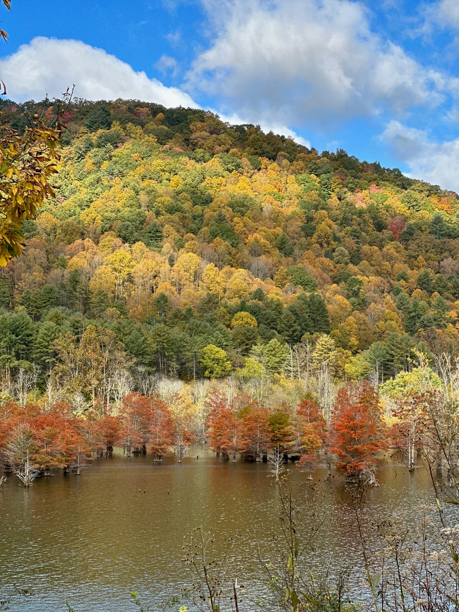
Fall (September–November)
The showstopper. Foliage peaks October 10 through 25 in most years. Reservations fill earliest for this stretch. The lake is still warm enough to swim through mid-September; by November it's coffee-on-the-porch season.
Winter (December–February)
Quiet, often beautiful. The lake doesn't freeze (it's too deep), but mornings are sharp and the views open up once the leaves fall. Skiing at Beech and Sugar Mountain is 35 to 40 minutes away. Pack for cold; the driveway is steep.
Annual events worth planning around
A few weekends each year fill the lake up. If you want to be here for them, book early. If you want to avoid them, book around them.
- Bristol Motor Speedway race weekends — April (Food City 500) and September (the Night Race). Every hotel within 50 miles sells out. The lake is one of the underused alternatives. Detail here.
- July 4 houseboat parade at Captain's Table — the loudest week of the year, but a real local tradition.
- Bassmaster tournaments on the lake — variable dates, watch the Bassmaster and B.A.S.S. Nation schedules.
- Watauga Lake Triathlon — annual, summer; brings athletes and their families.
- Appalachian Summer Festival in Boone — three weeks in mid-July through early August; Watauga Lake catches the overflow.
- Peak fall foliage — October 10–25 most years. The highest sustained demand of the calendar.
How to get here
Most people drive in. The nearest commercial airport is Tri-Cities Airport (TRI) in Blountville, TN, about 50 minutes from the lake. TRI is small but has direct flights to Atlanta, Charlotte, and a few other regional hubs. Asheville (AVL) is about two hours; Charlotte Douglas (CLT) is about three.
Driving distances to major cities, with normal traffic:
- Knoxville, TN — about 2 hours
- Asheville, NC — about 2 hours
- Charlotte, NC — about 3 hours
- Atlanta, GA — about 4 hours
- Nashville, TN — about 5 hours
- Washington, DC — about 7 hours
The last few miles of the approach are on smaller mountain roads. Cell service drops out before you arrive, so download your map ahead of time. Once you're at the lake, you'll be glad you did.
Where to stay
Our pitch, briefly
There are about a dozen vacation rentals on the lake. Most are older cabins at water level. A handful — six total, by our count — are modern townhouses up on the hill. Ours is one of them.
Two ensuite bedrooms, jet tub, gas fire pit, sweeping view of the lake and the Cherokee National Forest beyond it. Five minutes to the public boat launch. Sleeps six. Karen and Bill answer messages within an hour.
Dig deeper
Everything we've written about this lake
The bones of the site, organized by type. Every page on this list is something we'd hand a guest who asked a specific question.
Trails (8)
- 10 min Watauga Lake Trail
- 10 min Watauga Dam AT Crossing
- 25 min Laurel Fork Falls
- 25 min Pond Mountain
- 30 min Round Bald via Carvers Gap
- 35 min Tweetsie Trail (Rail-to-Trail)
- 45 min Grandfather Mountain
- 50 min Linn Cove Viaduct Trail
Places (13)
- 5 min Villa Nove Vineyards
- 5 min Watauga Lake Mercantile
- 8 min Butler Museum
- 10 min Shook Branch Recreation Area
- 12 min Watauga Dam
- 15 min Fish Springs Marina
- 20 min Captain's Table at Watauga Lakeshore Marina
- 20 min Watauga Lakeshore Resort & Marina
- 25 min Doe Mountain Recreation Area
- 25 min Doe River Covered Bridge
- 25 min Sycamore Shoals State Historic Park
- 30 min Roan Mountain State Park
- 55 min Grandfather Mountain State Park
Towns (8)
- 5 min Butler, Tennessee
- 15 min Mountain City, Tennessee
- 20 min Hampton, Tennessee
- 25 min Elizabethton, Tennessee
- 30 min Banner Elk, North Carolina
- 30 min Roan Mountain, Tennessee
- 40 min Johnson City, Tennessee
- 45 min Boone, North Carolina
Things to do
Long-form stories
Notes from the porch on seasons, history, food, and trip planning.
See all stories →