
Hiking the Watauga Dam section of the Appalachian Trail
What section and thru hikers should know about the Watauga Dam crossing — water, shelters, the lake walk, nearby hostels, resupply, and where to take a real rest day.
By Bill · May 24, 2026
On this page
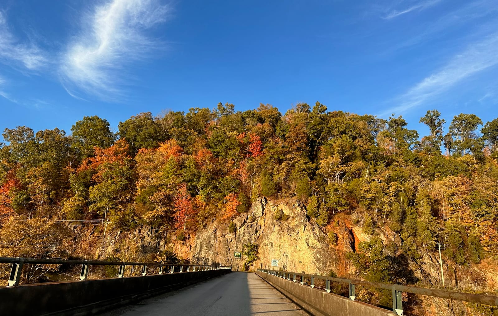
The Watauga Dam crossing is one of the more memorable structures on the southern half of the Appalachian Trail. You walk across the top of a 331-foot concrete and earth dam, with a 6,430-acre reservoir on one side and a drop-off into the lower river valley on the other. The cars on US-321 below look like Matchbox toys. It’s the only major dam crossing on the AT, and most thru hikers remember it.
This piece is for the people actually hiking the section — northbound thru hikers between Damascus and Erwin, southbound flips, and section hikers picking off the Tennessee piece of the trail. We host hikers at our place in Butler from time to time, and we have learned what the practical questions are: where to come off the trail, where the water is, where the resupply is, and what counts as a real rest day versus a hostel night.
The geography in plain terms
Watauga Lake is a long, narrow reservoir running roughly east to west between two ridges. The dam is at the east end. The AT enters the lake area from the south, walks across the south-shore lake walk going west to east, climbs the dam approach trail at the east end, walks across the top of the dam itself, and then climbs the ridge above the dam through pine and rhododendron to Vandeventer Shelter.
The major points of interest for a hiker in this section, west to east:
- Watauga Lake Shelter — at the southwest end of the south-shore lake walk, about 3.5 miles before the dam. Often the last shelter for a NOBO hiker before the dam crossing.
- The south-shore lake walk — 3.5 flat miles along the lake itself.
- Shook Branch Recreation Area — a TVA-managed picnic area on US-321 about midway along the lake walk. This is where most road-resupply and hitch traffic happens.
- Wilbur Dam Road junction — the AT crosses this paved road near the dam.
- Watauga Dam top crossing — about 0.4 miles end to end across the dam.
- Vandeventer Shelter — 5.5 miles past the dam, on the ridge, with a piped spring 0.2 miles down a side trail.
If you’re planning the day, the lake walk is morning miles for a NOBO. The dam crossing is photo-worthy, takes maybe 20 minutes if you stop to look. The climb to Vandeventer is moderate but goes uphill steadily for a couple of hours.
Water along the section
Surface water is reliable along the lake walk — you’re hiking next to a 6,430-acre lake — but lake water needs treatment. The water is generally clean for a Southern impoundment, but it gets recreational traffic, motorboats, and a fair amount of waterfowl. Filter, treat, or boil. Don’t skip it because the lake looks clear.
After the dam, the next reliable water is the piped spring at Vandeventer Shelter, which is 0.2 miles down a side trail behind the shelter. The spring runs year-round in normal weather but can slow to a trickle in late summer drought. NOBO hikers should plan to top off at the lake or at a piped spigot at Shook Branch before the climb, especially in August and September when the ridge gets dry.
There’s also a public spigot at the Shook Branch Recreation Area parking lot during the summer recreation season. It’s a clean, treated water source. If you’re coming through between Memorial Day and Labor Day, it’s the easiest fill on the section.
Coming off the trail at Shook Branch
The most common exit for section hikers is US-321 at Shook Branch Recreation Area. The lake walk crosses the road here at a TVA picnic area with parking, restrooms, and the spigot mentioned above. Cell signal is generally workable here — Verizon does best in this immediate area; see our cell service piece for the broader picture.
US-321 has steady traffic going east toward Hampton (5 miles) and Elizabethton (15 miles), and west toward Boone, NC (45 miles). Hitching east is the more practical direction for resupply, food, and lodging. Hitching west into North Carolina is doable but much longer for what amounts to similar resupply options.
If you have a phone, the Boots Off Hostel shuttle is the cleanest option (see below). If not, hitching from Shook Branch is straightforward — it’s a clearly marked AT parking area, drivers around here recognize hikers, and we have heard from guests that the average wait is under 15 minutes during daylight hours.
Where to stay
The established AT hostel for this section is Boots Off Hostel and Campground on Shook Branch Road, about a quarter mile off-trail. Bunks are around $40 plus tax (verify current prices), and the stay includes a shower with towels and soap, kitchen access, a continental breakfast, and a reasonable hot dinner. The owners shuttle from Wilbur Dam Road and from Shook Branch Recreation Area. The hostel is well-reviewed across recent thru-hike seasons. For most section hikers passing through who want a real bed for a night, it’s the natural pick.
If you want a private room, a real bed, a hot shower without sharing, and a kitchen — typically for a zero day or a slack-pack day — vacation rentals in the immediate Butler / Hampton / Elizabethton area are an alternative. Some of them, including ours in Butler, are about 10 minutes by car from Shook Branch. The trade-off is that a vacation rental typically requires a 2-night minimum and is priced for a couple or small group rather than a single hiker on a budget. The math works out when two or three hikers split a place for a single zero, or when family is meeting up to support a section.
A handful of B&Bs in Elizabethton and Hampton sometimes have one-night availability mid-week and are friendly to hikers. The Iron Mountain Inn in Butler is one. Call ahead — these places aren’t built around the AT crowd but they don’t turn hikers away.
Resupply
The closest full grocery is Food City in Hampton on US-321, about 5 miles east of Shook Branch. There’s also a Dollar General in Hampton for snack-and-shelf resupply. A larger Walmart and a full Food City are in Elizabethton, 15 miles further.
In a pinch, the Watauga Lake Marina and Lakeshore Resort near Shook Branch carries a small selection of snacks, drinks, and basic supplies during the summer recreation season. Not a true resupply, but it’ll keep you fed for a night.
There’s no outfitter in Hampton. Mountaineer Outdoor Gear in Boone is the closest real gear shop with stove fuel, replacement gear, and any apparel needs. It’s a 45-minute drive — not a daytrip for a thru hiker on schedule, but worth knowing if you need a gear replacement and can hitch to Boone or get a ride.
The lake walk itself
People who haven’t hiked this section don’t always realize how pleasant the south-shore lake walk is. It’s a flat, well-graded, well-shaded 3.5 miles along the south side of Watauga Lake. The trail is mostly within 20-100 feet of the shoreline, and the lake is visible on your left almost the whole way north. You walk under hemlocks and rhododendron in the cooler parts, through small clearings with lake views, past a couple of small swimming-friendly coves where day hikers and locals come down from US-321.
For NOBO thru hikers who have just done the climb out of Damascus, the lake walk is the first proper “easy” stretch of trail since the long roller along the Iron Mountain. You will see day hikers, sometimes dogs, sometimes families. Most are friendly and curious. A surprising number have read the AT books and will offer water if you look thirsty.
If you’re a section hiker doing this stretch as a single overnight, start at Damascus and walk to Shook Branch in two days, with a night at Iron Mountain Shelter or Double Springs Shelter. That gives you the lake walk and the dam on the morning of day three. It’s a manageable trip.
The dam crossing itself
You start the dam crossing from the east end of the lake walk via a short climb up the dam approach trail. The trail emerges onto the top of the dam, which is a paved walkway about 20 feet wide with a fence on the lake side and an unfenced drop-off on the river side. Most hikers walk the lake-side line on instinct.
The crossing is 0.4 miles end to end. It takes about ten minutes if you’re moving. Most hikers take 20-30 because the views are real — the lake stretching west to the upper end and Pond Mountain rising up on the south, the river valley dropping away to the east toward Elizabethton, the dam face itself dropping a sheer 30 stories down. There’s usually a breeze across the top regardless of weather. In the summer it’s notably cooler on the dam than in the woods. In winter it can be brutally windy and you’ll want a windbreaker for the crossing even if you didn’t need one all morning.
A few practical notes:
- The walkway is fully exposed. No shade, no shelter. In a thunderstorm, don’t cross the dam — wait it out at the Watauga Lake Shelter or in the woods on either side. The dam is a high point with no cover.
- There’s no water on the dam itself. Top off before you start.
- Cell signal on the dam is the best you’ll get in this section. Verizon and AT&T both get a clear line of sight to the towers above Elizabethton. If you need to make a phone call about your shuttle or your evening plans, the dam is the place.
- The drop-off side is real. It’s not the kind of crossing where casual missteps put you in serious trouble — the walkway is wide and the fence is on the lake side — but don’t roughhouse and don’t drink and cross. We have heard from TVA of one or two incidents over the years and the locals take that drop seriously.
The climb out of the dam to Vandeventer
The climb from the east end of the dam up to Vandeventer Shelter is about 1,200 feet over 5.5 miles, with the steepest grade right out of the dam. The trail switchbacks up through hemlock and rhododendron and emerges onto a pine-and-laurel ridge that runs east-west on top of Iron Mountain. The footbed is rocky in places but not technical. Most NOBO hikers handle it in two to three hours.
Vandeventer Shelter sits on a knob just south of the trail. Privy. Sleeps six. The piped spring is 0.2 miles down a side trail behind the shelter — clearly marked — and is the next reliable water source you’ll have until the descent toward Watauga Brook several miles further north. Plan accordingly.
The view from the rocks behind Vandeventer is one of the better view shelters on the Tennessee AT. You can see the whole length of Watauga Lake from up there, with the dam in the distance. On a clear evening in spring or fall it’s worth dropping the pack and walking out for sunset.
Hard Core and the Damascus connection
Many of the hikers we see in this section are coming through in mid-May or doing the section in fall. Trail Days in Damascus runs the third weekend of May, and the Hard Core trail cleanup in the days before Trail Days draws volunteer hikers to work on the AT between Damascus and Roan Mountain — including the section that includes Watauga Dam. If you’re hiking in late May, expect the trail to be in better shape than it was the previous fall.
A useful tradition: if you’re a section hiker timing your trip around Trail Days weekend, hike north into Damascus on the Wednesday or Thursday, attend Friday and Saturday, then resume south or be shuttled back to your finish point on Sunday. Damascus is about 40 miles from the Watauga Lake area along the trail, but the festival pulls in hikers from the whole region. We have hosted guests doing this exact pattern.
Off-trail rest at our place
We host hikers at the townhouse from time to time — not as a hostel, but as a private rental for a zero day or two. The case is straightforward: we’re 10 minutes by car from Shook Branch, we have a real bed and a real shower and a kitchen, we have solid WiFi for catching up with family, and we’re not on-site so you have privacy. The two-night minimum is the catch. Some hikers split the place with their support family meeting them in town, which works well.
If a hostel night is what you need, Boots Off is the right call and we will tell you so. If a private rest day is what you need, the property page has the specifics and the booking page has dates. We’ll tell you straight whether it’s the right fit.
What we’d tell a friend planning the section
A handful of small things that aren’t obvious from the AWOL Guide:
- Top off water at Shook Branch in summer. The piped spigot is a treated source and the next reliable water after the climb is at Vandeventer, where the spring can run low.
- Plan the dam crossing for late morning or early afternoon. Thunderstorms in this region typically build in the late afternoon in summer. Crossing the dam during a thunderstorm is unpleasant at best.
- Don’t underestimate the climb out of the dam. It looks short on the map. It is steady steady work in the heat.
- The lake walk has poison ivy on the edges in summer. Watch where you sit when you take a break.
- If you’re flipping or jumping sections, the Tri-Cities Airport (TRI) is the closest major airport. The drive from TRI to Shook Branch is about 35 minutes; see our airport guide for the route.
Hike your own hike. If you stop by our porch on a zero day, the coffee’s on.
Want to stay at the lake?
Our modern two-bedroom townhouse has sweeping lake and mountain views, a jet tub, and a gas fire pit on the back porch.
Common questions
Where exactly does the AT cross Watauga Dam?
What's the closest road crossing for resupply or pickup?
Is there a hostel near the Watauga Dam AT crossing?
Where's the water along this section?
How long is the lake walk on the AT?
More like this
Keep reading
Cell service, WiFi, and going off-grid at Watauga Lake
A real read on cell service and WiFi at Watauga Lake. Carrier reality, the WiFi-calling fix, and the
Where to stay on Watauga Lake
A practical look at where to stay around Watauga Lake — the lakefront cabins, the hilltop townhouses
Watauga Lake on a budget
The cheap version of a Watauga Lake trip done right. What's free, what's worth the splurge, where to
Cherokee National Forest from Watauga Lake
Watauga Lake sits inside the Cherokee National Forest, which is most of why the shoreline is undeveloped and the water is so clear.