
Old Butler — the town under Watauga Lake
The story of Old Butler, Tennessee, the only incorporated town the TVA ever flooded, and the families who moved their houses up the hill before the water rose in 1948.
By Bill · April 11, 2026
On this page
Karen and I moved here from Florida four years ago, and the first time someone said “the old town is under the lake,” I thought it was the kind of story people tell to make a place sound interesting. It turns out the story is true, and once you start pulling at it, it is the story of this whole valley. So this is the long version, as best as we have been able to piece it together from the Butler Museum, the TVA’s own history pages, and a couple of long afternoons with people whose grandparents lived in Old Butler.
If you have only got a few minutes, here is the short version. In 1948 the Tennessee Valley Authority closed the gates of the Watauga Dam, the valley behind it filled with water, and the town of Butler, Tennessee, founded in the 1820s and home to about six hundred people, ended up at the bottom. Before the water rose, the residents moved their houses, their churches, their post office, and their dead, up the hill to higher ground. The new Butler sits a mile north of where the old one was. The lake you are now looking at covers the rest.
That is the bones of it. The flesh is more interesting.
What was there before
The Watauga Valley was settled by Europeans in the 1760s, which by Tennessee standards is early. People had been here longer than that, of course. The Cherokee used the valley for hunting and had a settlement at the mouth of the Doe River. The first white settlers were mostly Scots-Irish farmers coming down from Virginia, and they built a string of small communities along the Watauga River where it ran flat through the bottomland.
Butler, originally called Smith’s Mill, was one of those communities. By the 1820s a man named Roderick Butler had set up shop there, and the place took his name. It sat where the Roan Creek and the Watauga River come together, which made it a natural junction for the wagon roads coming over the mountains from North Carolina. By the late 1800s it had a railroad spur, a depot, a hotel, a bank, two churches, a school that went through twelfth grade, and a strip of stores along what people called Main Street. The 1940 census put the population at about six hundred, but on a Saturday afternoon when the surrounding farms came in to trade, it felt bigger than that.
The Watauga River had always been a problem. It flooded. Anybody who lived in the valley accepted floods the way people on the Florida coast accept hurricanes. The 1901 flood took out half the businesses. The 1924 flood took out the rest, and they rebuilt. In May 1940 a flood killed six people in the lower valley, washed away most of the Elizabethton-to-Mountain City railroad, and convinced the TVA that something had to be done about the Watauga.
The dam decision
The TVA was less than a decade old in 1940. Roosevelt had created it in 1933 to bring flood control, electricity, and economic development to one of the poorest regions of the country. By 1940 it had already built the dams that created Norris Lake, Cherokee Lake, Douglas Lake, and Fontana, and was looking up into the headwater valleys for the next set.
The Watauga site was on the engineers’ wishlist for years before 1940. The geology was right for a high earthen dam. The narrow gorge below the proposed dam site was a natural plug. The reservoir behind it would hold back the kind of water that had been killing people downstream for a century. And the dam itself would generate hydroelectric power.
The flood in 1940 ended the debate. The TVA broke ground on the Watauga Dam in early 1942. Construction stopped later that year when the country redirected steel and concrete to the war effort. It resumed in 1946 and finished in 1948. The finished dam is 331 feet tall, one of the tallest earthen dams in the eastern United States. The reservoir it created — Watauga Lake — is 6,430 acres, with 104.9 miles of shoreline, 16.3 miles long end to end, and 265 feet deep at its deepest point.
When the gates closed on December 1, 1948, the valley behind them began to fill. By the following spring it was a lake.
The move
The TVA notified the people of Butler in 1941 that the town was going to be flooded. That gave them seven years, which sounds like a lot, but the war took most of it. The actual relocation happened in a rush between 1946 and 1948.
Here is what makes the story particular. The TVA was used to acquiring land through eminent domain for its projects. Farms, forests, scattered houses, sometimes whole hamlets. But Butler was the only fully incorporated town the TVA ever flooded. It had a mayor, a town council, a tax base, a school district, a post office with a postmaster. Moving a town is not the same as moving a farm.
The federal government paid for what they took. The prices were not generous. People who had owned land in the valley for four generations were offered fair-market value as the TVA appraised it, which often meant less than what the land actually meant to the people who owned it. There were holdouts. There were lawsuits. Most of them lost.
Then came the physical move. Five different house-moving contractors worked in Butler between 1946 and 1948. They jacked up about 125 houses, set them on rolling timbers, hauled them up the hill with mules and tractors, and put them down on new foundations a mile to the north. Some of those houses are still standing in the new Butler today. If you drive through the new town and see a board-and-batten farmhouse with old-growth oak floors and a stone chimney, there is a reasonable chance it is an Old Butler house that made the trip.
The churches moved. The Methodist church moved as a complete building. The Baptist church was disassembled and rebuilt on new ground. The post office moved. The bank moved. The school did not move — it was demolished and a new one was built on the hill.
The hardest part was the cemeteries. The TVA was required by law to relocate any graves that would be submerged. They moved more than a thousand burials out of the lowland cemeteries up to new cemeteries above the waterline. Families were given the option of relocating their own loved ones to a cemetery of their choice. Most agreed to the TVA’s plan. Some did not, and stories still circulate in Johnson County about families who refused, and about the few graves that are still down there.
By the autumn of 1948 the valley had been emptied of everything the residents could take. What remained was foundations, road traces, fence posts, orchard trees, and the railroad bed. The gates closed in December. The water came up over the winter and spring. By summer of 1949 the valley was a lake and the new Butler was a town on the hill, finding its footing.
The new Butler
The relocated community was originally called Carderview after a local landowner. It did not stick. Within a few years people were calling it Butler again. The post office was officially renamed in the early 1950s.
The new town never recovered the population of the old one. By 1960 it was around four hundred, and by 1980 around two hundred. The railroad spur was gone. The bottom-land farms that had supported the original economy were under water. Most of the families that stayed pivoted to the lake — boat-building, marinas, tourism, vacation rentals. Some left for Elizabethton or Johnson City. The school consolidated with Mountain City in the 1960s.
Today the new Butler is small, quiet, and largely residential. The Mercantile up Dry Hill Road is the unofficial town square. The post office is a small brick building on the main road. There is no traffic light, which residents will tell you is a feature, not a bug. The lake is two minutes away in any direction. Karen and I live up the hill from town in one of the newer hilltop neighborhoods. Our house was not part of the relocation. Some of our neighbors’ grandparents’ houses were.
The Butler Museum
The practical pilgrimage, if you are interested in any of this, is the Butler Museum at 123 Cobb Street in the new Butler. It is technically called the Butler and Watauga Valley Heritage Museum, and it is run by the Butler and Watauga Valley Heritage Association, which is a small nonprofit that has been keeping this history alive since 2000.
The museum is not big. Two main rooms in a former school building. But the artifact collection is remarkable for a town of this size. There are pieces of the original post office. The original barbershop chair. A barber’s pole. Schoolbooks from the Old Butler school. Photographs, hundreds of them, of the town before the flooding — Main Street on a Saturday, the depot, the hotel, baptisms in the Watauga River, weddings, funerals, school graduations. There is a topographic model of the original valley with the dam site marked. There is a slide show of the move itself, with footage of houses on rollers being pulled up the hill by tractors.
The volunteers who staff it are mostly people whose families lived in Old Butler. If you go, ask them about it. They will tell you stories you cannot get from the placards.
Hours are seasonal, generally Thursday through Saturday in the warmer months, and by appointment otherwise. Admission is free, donations welcome. The phone number and a current schedule are on their website. Call before you drive over, because the small-town museum life means hours sometimes shift.
A note on the recent grant news. In late 2025 the Tennessee State Museum awarded the Butler and Watauga Valley Heritage Association a Capital Maintenance and Improvements grant for facility upgrades, and a separate state grant from Senator Crowe and Representative Hill funded a new exhibit. If you visit in 2026 or 2027 you may find new exhibit space and an improved HVAC system. The basic collection is the same.
”Half Mile Down”
If you want to prepare yourself emotionally for the museum visit, listen to “Half Mile Down” by Old Crow Medicine Show before you go. It is on their 2012 album. The song tells the story directly. The opening lines describe TVA surveyors arriving in the valley with their plans. The chorus is the perspective of someone half a mile down, under the water, looking up. It is the only piece of popular music I know of that takes Old Butler as its subject. The band has connections to East Tennessee, and they tell the story straight.
It is a short song, about four minutes. Pull it up on whatever you use for music. Then go to the museum. The combination is something.
Why the story still matters
When Karen and I are sitting on the back porch in the evening looking out at the lake, I sometimes catch myself thinking about what is under it. The road that ran through town. The schoolhouse foundation. The Methodist cemetery, the part that did not get moved. Somebody’s front porch where they sat in 1947, the summer before everything changed.
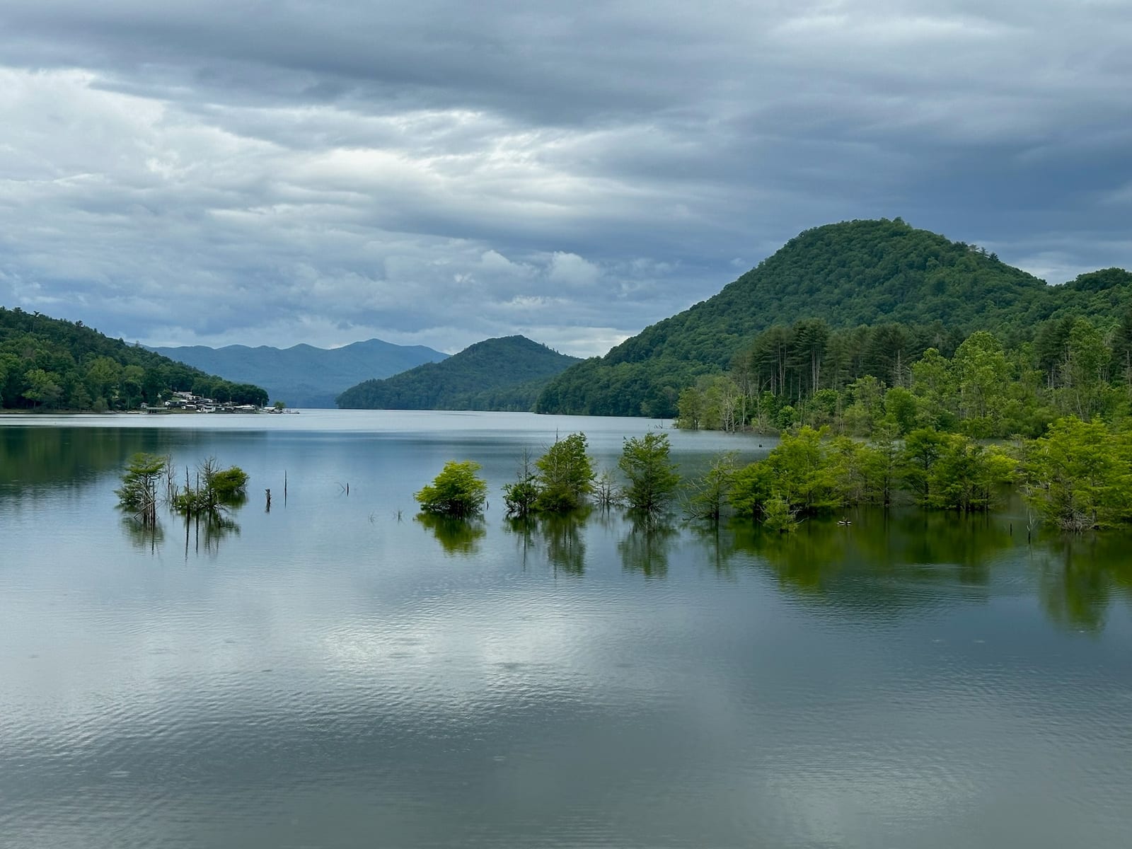
It is easy to look at Watauga Lake and see a beautiful natural feature. It is mostly that. The Cherokee National Forest on three sides, the mountains beyond, the clean water. But it is not entirely natural. It is the result of a decision the federal government made in the 1940s, paid for with the homes and livelihoods of about six hundred people who did not have much choice in the matter. The flood control and the electricity have benefited millions of people downstream over the past seventy-five years. That is a real benefit. It also came at a real cost, paid by one small valley.
The Butler Museum exists to make sure the people who paid that cost are remembered. The song exists to make sure their story is heard. The new town exists because the families decided that they would rebuild rather than scatter. The phrase the locals use for all of this is “the town that wouldn’t drown.” That captures the spirit of it. The town did get flooded, in the literal sense. The community did not.
If you stay with us, plan an hour or two for the museum. It is six minutes from the townhouse. Take the drive slowly. Look at the lake on the way over. Read the placards. Talk to the volunteers. Listen to the song on the drive back. The lake will look different to you afterward. That is the point.
Practical notes for visiting
The museum is at 123 Cobb Street in Butler, Tennessee. Free parking. The building is on a slight slope, but ramp access is available. Check the most recent hours by phone before you go — the volunteers post a schedule but it changes.
If you want to see the dam itself, drive out on TN-67 from Hampton toward the dam observation area. The view from the top is worth it on a clear day. The Appalachian Trail crosses the dam on its way north, and you can walk a short stretch of it on the dam itself, which is a strange and good feeling — standing on the wall that holds back the lake that covered the town.
The new Butler does not have many places to eat. The restaurant guide covers your options. The Mercantile is the closest and works for lunch.
If you want to make a half-day of it: museum in the morning, lunch at the Mercantile, dam observation in the afternoon, listen to “Half Mile Down” on the way back. That is what we tell guests who ask. That is the trip.
Want to stay at the lake?
Our modern two-bedroom townhouse has sweeping lake and mountain views, a jet tub, and a gas fire pit on the back porch.
Common questions
Is Old Butler really under Watauga Lake?
Can you see anything of the old town?
Where is the Butler Museum?
Is there really a song about Old Butler?
More like this
Keep reading
Where to stay on Watauga Lake
A practical look at where to stay around Watauga Lake — the lakefront cabins, the hilltop townhouses
Fall foliage at Watauga Lake — when, where, and what nobody tells you
When fall color peaks at Watauga Lake, which drives and trails are the best for it, and the timing t
Cherokee National Forest from Watauga Lake
Watauga Lake sits inside the Cherokee National Forest, which is most of why the shoreline is undeveloped and the water is so clear.
The Appalachian Trail at Watauga Lake
The AT crosses on top of Watauga Dam — a 15-minute drive from the door, with one of the most photographed views on the entire 2,200-mile trail.