
Visiting Watauga Dam — what to know before you go
How to visit Watauga Dam — public access, the AT crossing on top, the TVA picnic area below, photography spots, and what's actually allowed.
By Bill · May 25, 2026
On this page
Watauga Dam is one of the more dramatic infrastructure visits in east Tennessee. A 331-foot-tall earth-and-rockfill dam, holding back the 6,430-acre Watauga Lake, with the Appalachian Trail walking across the top. Most visitors don’t know they can see it up close — you can.
This is the practical guide for visiting Watauga Dam yourself.
The basics: what kind of “tour” is this?
Set expectations: there is no scheduled docent tour, no guided walk-through, no powerhouse interior visit. TVA does not currently offer guided tours of Watauga Dam.
What you CAN do:
- Walk across the top of the dam (the AT crossing is open to public foot traffic year-round)
- Visit the TVA picnic area below the dam (daylight hours, free)
- Drive to the dam viewpoints on Wilbur Dam Road
- Photograph the dam from various angles, no permits needed for casual photography
That’s it. A “Watauga Dam tour” is really a self-guided visit. It’s still worth doing — the scale of the structure and the view from the top are remarkable.
Getting there
Driving directions:
- From the lake-area townhouse rentals: about 10 minutes
- From Elizabethton: 20 minutes
- From Hampton: 5 minutes
- From Johnson City: 35 minutes
- From Tri-Cities Airport (TRI): 40 minutes
The route is straightforward: take US-321 to Wilbur Dam Road, then follow Wilbur Dam Road to the dam. Wilbur Dam Road dead-ends at the dam area, so it’s hard to miss. Cell signal gets unreliable on the last stretch (see our cell service piece), so map the route before you leave.
Parking:
- The main parking lot is at the south end of the dam, on Wilbur Dam Road
- Limited spaces — maybe 15-20 cars
- Free
- On busy weekends in October, the lot fills by 10 AM
Alternate parking:
- The TVA picnic area below the dam has its own parking lot, accessed by a road that branches off Wilbur Dam Road and descends to the river
- This is where you go if you want to see the dam from below rather than walk across it
What there is to see
From the south parking lot
You park, you walk a short distance to the dam approach trail. Looking east, you can see the south end of the dam rising 331 feet above the river valley below. The Appalachian Trail markers point to the climb.
The dam approach trail
The AT climbs from the parking lot to the top of the dam over about a half-mile. It’s a real climb — about 250 feet of elevation gain on a switchbacked path through hemlock and rhododendron. Not technical but not flat either. Takes most people 15-20 minutes.
The trail emerges onto the south end of the dam top.
The dam top — what you actually see
Length: about 925 feet from south end to north end of the dam top Width: about 20 feet of paved walkway (the AT goes across) Drop on the river side: about 280 feet of nearly vertical rockfill View from the top, lake side: Watauga Lake stretching west toward the upper basin and the surrounding mountains View from the top, river side: the Watauga River valley dropping toward Elizabethton, with the river curling away in the distance Wind: almost always significant. The dam is at a saddle between two ridges; wind funnels through. Pack a windbreaker even on warm days. Surface: paved asphalt walkway with a metal railing on the lake side, an unfenced drop on the river side. Walk the lake-side line if heights bother you.
The crossing takes 10-15 minutes if you stop to look (most people do).
The north end of the dam
The AT continues from the north end of the dam up onto Iron Mountain and toward Vandeventer Shelter. Most casual visitors turn around at the north end and walk back. AT thru-hikers continue.
The TVA picnic area below the dam
If you’d rather not climb to the top, the picnic area below offers a different perspective.
What’s there: Picnic tables, restrooms (open in season, closed in winter), parking for about 10 cars, and a clear view up the dam face from the river side.
The view: Looking up at the dam face is striking — the rockfill scales up dramatically when you’re below it. You can hear the powerhouse running (or not running) depending on TVA’s generation schedule.
The river: Below the dam picnic area, the Watauga River runs cold and trout-stocked. Fly anglers fish this water (see our fly fishing guide). Casual visitors can walk along the river bank and watch the water.
Bear safety reminder: The picnic area is in active bear country. Don’t leave food unattended.
When to visit
Best for photography: early morning. The light at sunrise hits the dam face and the surrounding mountains in golden light. The crowd hasn’t arrived yet. The wind is usually lower.
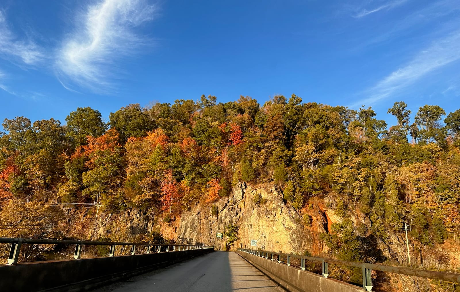
Best for foliage: October 10-25. Peak fall color on the surrounding ridges turns the dam visit into one of the most photographed natural scenes in the region. The dam-road-fall-foliage view (the road approaching the dam framed by ridges in peak color) is the iconic shot. See fall foliage piece.
Best for family weekend: spring through early summer. Mild weather, lake water rising back to full pool, wildflowers along the approach trail.
Avoid: severe weather days. The dam top is exposed and there’s no cover. Thunderstorms are dangerous; cold winter wind is brutal. Check the forecast before you commit.
Photography notes
Best vantage for the dam itself from outside:
- The “dam-road-fall-foliage” angle: from the road approaching the dam, looking up at the structure with the surrounding ridges in frame. The exact spot is on Wilbur Dam Road, where the road curves and the dam becomes visible.
- From the picnic area below: looking up the dam face. Best in late afternoon when the dam catches warm light.
- From the dam top: the lake-side view stretching west is the wide-angle photographer’s shot.
Best gear:
- Wide angle lens (16-35mm equivalent) for the dam top views
- Telephoto (70-200mm) for picking out details on the dam face from below
- Tripod for early-morning low-light shots
- Polarizer cuts glare off the lake surface
Drone photography: TVA restricts drone flights over the dam itself. Recreational drones are prohibited in TVA security zones. Don’t fly without checking current rules; FAA TFRs sometimes apply.
Commercial photography: Weddings, paid portraits, professional video productions require a TVA filming permit. Apply through tva.gov. Casual visitor photography is fine without permits.
What to bring
A short list specific to dam-area visiting:
- Layers. The dam top is windy and cold even on warm days.
- Water. No drinking water on the dam top. Bring a bottle.
- Snack. The picnic area has tables but no food sales.
- Camera. Phone is fine for the wide views; bring a real camera for serious foliage shots.
- Closed-toe shoes. The trail to the dam top is dirt and rocky in places.
- Sun protection. The dam top is fully exposed. Hat and sunscreen.
The dam in context
If you’re spending time at the dam, the surrounding sites are worth pairing:
Above the dam: the lake itself. Drive to Shook Branch Recreation Area (5 minutes east of the dam) for a south-shore swim/picnic spot. Or drive to Watauga Point on the north shore (15 minutes).
Below the dam: Wilbur Dam, the smaller re-regulation dam about a mile downstream. Wilbur Lake is small but worth a brief stop. Continue further downstream to Elizabethton for the Doe River Covered Bridge and Sycamore Shoals State Historic Park.
The dam in regional context: Watauga Dam is part of the TVA system that includes 49 dams across the southeast. Norris Dam (about 2.5 hours west) is the only one currently offering powerhouse tours. South Holston Dam (about 45 minutes east) is similar in scale and approach to Watauga.
A few things visitors regret not knowing
The trail to the dam top is steeper than it looks. People underestimate the climb. Bring water and don’t try to do it in flip-flops.
Wilbur Dam Road is narrow. Passing oncoming traffic is sometimes tight. Drive defensively.
The dam top has no shade. If you’re sensitive to sun, plan for morning or late afternoon visits.
The picnic area gates close at dark. Don’t get stuck on the wrong side.
Cell signal is bad here. GPS may struggle on Wilbur Dam Road. Set your route before you leave.
TVA generation can change the soundscape. When generators are running, the powerhouse is loud and the river below the dam is high. When generators are off, it’s nearly silent. Either is interesting; the contrast is striking.
Pairing with other activities
The Watauga Dam visit is short — usually 1-2 hours for the full self-guided tour. Most visitors pair it with one or more of:
- A morning hike on the AT lake walk (south shore, before the dam, 3.5 miles flat) — see our trail entry
- Lunch in Hampton at Iron Mountain Grille or one of the small spots near US-321
- A drive to Shook Branch for a swim or picnic afterward
- A winery stop at Watauga Lake Winery (10 minutes from the dam)
- A photography loop with Pond Mountain summit or the Carvers Gap drive
- A Cherokee NF hike — see our day hikes guide
A typical full-day visit centered on the dam might look like: 8 AM arrive at south parking lot, 8:15-9:30 walk the dam top, 9:30-10 stop at the picnic area below, 10-11:30 drive to Watauga Lake Winery for late-morning tasting, lunch in Hampton, afternoon swim at Shook Branch.
For section hikers and thru-hikers
If you’re walking the AT, the dam crossing is the most photographed point in the Tennessee section of the trail. See our section hiker logistics guide for the practical details — water, shelters, resupply, where to stay between Damascus and Erwin.
For everyone else, see our property page for where to stay locally, and the booking page for the calendar.
Why it’s still worth the trip
Watauga Dam isn’t a “destination tour” the way a Hoover Dam visit is — there’s no visitor center, no scheduled programming, no gift shop. It’s an infrastructure visit and a hiking experience and a photography opportunity. For people who appreciate the scale of TVA’s mid-century work and the way the Appalachian Trail walks across actual working infrastructure, it’s one of the more memorable stops in the region.
Bring a real camera and arrive early.
Want to stay at the lake?
Our modern two-bedroom townhouse has sweeping lake and mountain views, a jet tub, and a gas fire pit on the back porch.
Common questions
Can you actually visit Watauga Dam?
How do you get on top of the dam?
Are there guided tours of the powerhouse?
Is photography allowed?
When is the best time to visit?
More like this
Keep reading
Hiking the Watauga Dam section of the Appalachian Trail
What section and thru hikers should know about the Watauga Dam crossing — water, shelters, the lake
Watauga Lake facts — elevation, depth, surface area, history
The factual basics of Watauga Lake — elevation, depth, surface area, the dam, the drowned town, and
Old Butler — the town under Watauga Lake
The story of Old Butler, Tennessee, the only incorporated town the TVA ever flooded, and the familie
The Appalachian Trail at Watauga Lake
The AT crosses on top of Watauga Dam — a 15-minute drive from the door, with one of the most photographed views on the entire 2,200-mile trail.