
Cherokee National Forest day hikes near Watauga Lake
Day hikes we send guests on — from a flat lakeside walk to a 1,500-foot climb to a famous grassy bald — all inside Cherokee National Forest near the lake.
By Karen & Bill · May 24, 2026
On this page
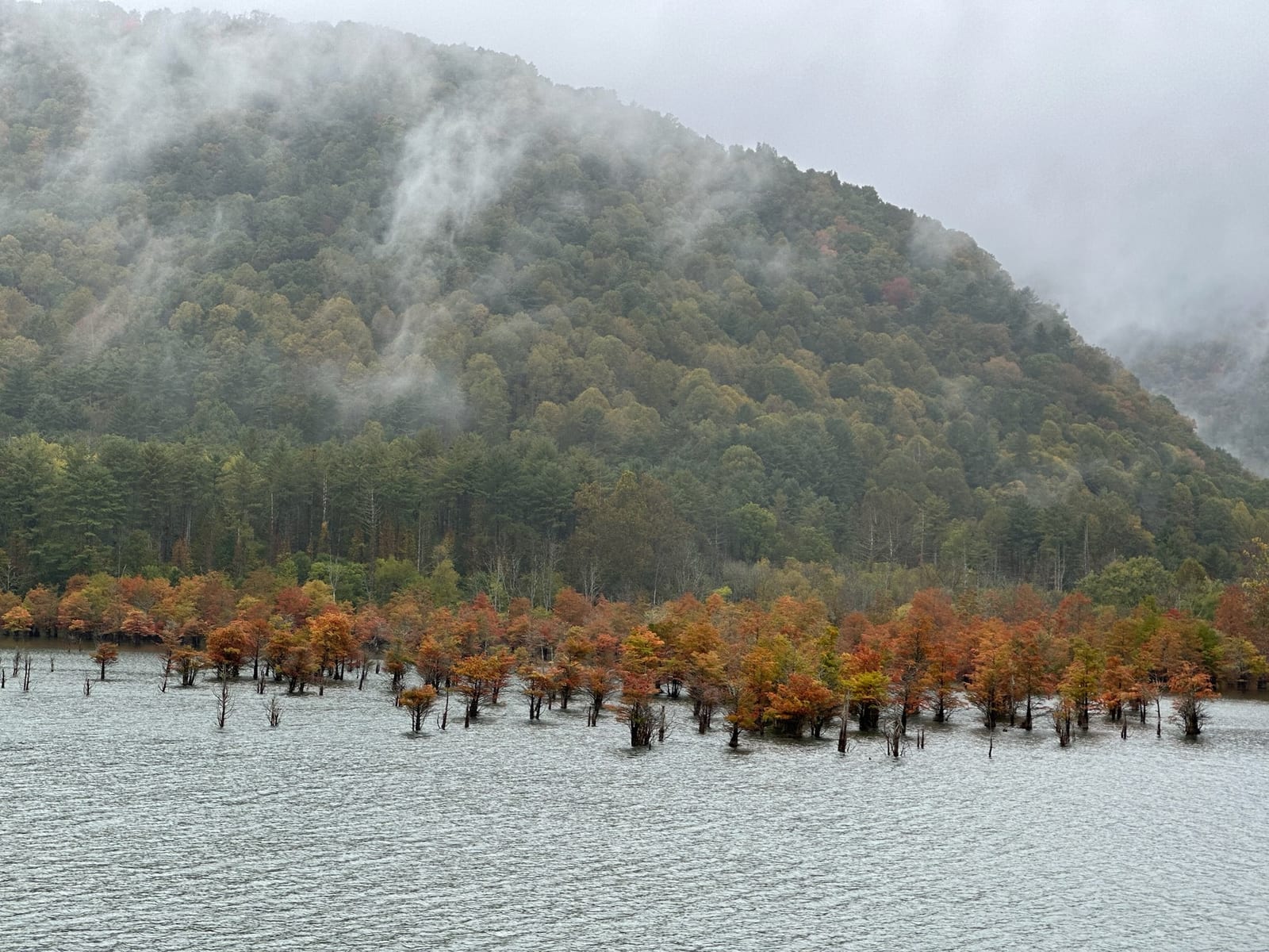
We live next to one of the largest national forests east of the Mississippi and most of our guests don’t know they’re in it. Cherokee National Forest is 650,000 acres of east Tennessee mountain country, running for 100-plus miles along the Tennessee–North Carolina border. Watauga Lake sits in the eastern portion of it, in the Watauga Ranger District, and the trails that come off the lake or run through the ridges above it represent some of the best day hiking in the region.
This piece is the short version of what we send guests when they ask “where should we hike for a day?” We’ve spent two years walking these trails in every season and the answers depend on what kind of day you want.
The geography in plain terms
Cherokee National Forest is split into two parts by the Great Smoky Mountains National Park in the middle. The northern half — where we are, near Watauga Lake — runs from the Virginia line south to the Smokies. The southern half runs from the Smokies south to Georgia.
The northern half is divided into ranger districts. We’re in the Watauga Ranger District, which manages the trails immediately around Watauga Lake and the high country to the south at Roan Mountain. To our north is the Unaka Ranger District, which covers the area around Erwin and the Nolichucky River. To our south, across the Smokies, are the Cherokee districts that don’t matter for a Watauga Lake day-hiking trip.
What this means in practice: from a rental on Watauga Lake, you can be at a national forest trailhead in 10-45 minutes, depending on which trail. Most of the best ones are inside that window.
The five day hikes we actually recommend
These are the trails we send guests to most often. The order is rough — easiest to hardest, then by what kind of day they’re best for.
1. Watauga Lake Trail — easy, flat, lakeside
Distance: 1-3 miles, choose your own length Elevation gain: Effectively none Drive from the lake: 10-15 minutes to Shook Branch Recreation Area Best for: Kids, grandparents, dogs (leashed), a morning before the lake gets hot
A flat, well-graded path along the south shore of Watauga Lake. You park at Shook Branch Recreation Area on US-321, walk west along the lake on the AT (yes, this is part of the Appalachian Trail), and turn around whenever you’ve had enough. The full one-way length to the Watauga Lake Shelter is about 3.5 miles, but most casual walkers turn around at one of the small coves a mile or two in.
The lake is visible the whole way on your left. Water access points along the trail let you sit on a rock and dip your feet in summer. In spring, mountain laurel blooms heavily through this stretch. In fall, the south shore catches the morning light beautifully and the trail walks through a mile-long corridor of yellow hickory leaves.
2. Laurel Fork Falls — easy-moderate, with a real waterfall payoff
Distance: 5 miles round trip Elevation gain: ~500 feet Drive from the lake: 20 minutes to Dennis Cove Best for: A half-day hike with a swimming hole at the end
A short hike to a 50-foot waterfall in a hidden gorge. You park at Dennis Cove on a small forest road south of Hampton, follow the AT briefly, then break off onto the Laurel Fork Falls side trail and walk through a gorge with the creek on your left. The trail is well-graded but rocky in places. The falls themselves are dramatic — 50 feet of water hitting a pool at the bottom of a narrow gorge — and the pool is swimmable in summer (cold, but swimmable).
Most impressive after heavy spring rain. Quiet on weekdays. The trailhead parking is small, so weekend mornings fill up by 10 AM; arrive by 9 or hike on a weekday.
3. Round Bald via Carvers Gap — moderate elevation, world-famous view
Distance: 0.6 miles round trip to Round Bald summit; 5 miles to walk further along the bald ridge Elevation gain: Modest from Carvers Gap (the parking lot is already at 5,500 feet) Drive from the lake: 45 minutes to Carvers Gap Best for: Anyone who wants a big view without a big climb; June rhododendron bloom
Carvers Gap is the highest trailhead parking in the area — you drive up to 5,500 feet on TN-143, park, and walk uphill for half a mile through wind-stunted spruce to emerge onto a grassy treeless mountain summit at 5,800 feet. The view from Round Bald is genuinely one of the best in the southern Appalachians. On a clear day you can see for 60-plus miles in every direction.
You can keep walking past Round Bald along the Roan Highlands — a 5-mile ridge of grassy balds with no trees, no shade, and miles of view. Most casual hikers turn around after Round Bald or one bald further. Serious hikers continue to Jane Bald or Grassy Ridge, which adds significant mileage.
In mid-June, the rhododendron blooms on Roan Mountain are famous. People come from across the region for it. The flame azalea bloom is similarly remarkable in early June. Plan for crowds at Carvers Gap on those weekends.
4. Watauga Dam AT Crossing — moderate, with the most-photographed view in the area
Distance: 1.5-3 miles round trip depending on your turnaround Elevation gain: ~300 feet up to the dam, then flat across Drive from the lake: 10 minutes to Wilbur Dam Road parking Best for: A photo-worthy short hike; the dramatic story of walking the AT across a working dam
You park on Wilbur Dam Road, walk up the dam approach trail (a steep half-mile climb through hemlock), emerge onto the top of the dam, walk across the 0.4-mile dam top, and look at one of the more dramatic engineering-meets-nature views in the southern Appalachians. The lake is on your left, a 30-story drop into the river valley on your right.
You can turn around at the far side of the dam or continue along the AT on the south shore (which connects to the lake walk described in #1). Either way, the dam crossing itself is the highlight.
If you’re a section hiker actually walking the AT through here, see our longer piece on the Watauga Dam AT section. For day hikers, the dam crossing is a 90-minute outing.
5. Pond Mountain — strenuous, summit reward, full-length lake view
Distance: 4 miles round trip Elevation gain: ~1,500 feet Drive from the lake: 15 minutes to the trailhead Best for: Hikers who want a real climb and the best summit view of the lake itself
The steepest hike on this list. From the trailhead at the base, you climb 1,500 feet over 2 miles to the Pond Mountain summit at 3,800 feet. The trail is well-marked but rocky and steep — there are places where you’re hand-on-rock for short stretches. Most hikers take 2-3 hours up, 1.5-2 hours down.
The payoff is the only summit view in the region where you can see the full length of Watauga Lake in a single frame. The lake stretches west under your feet, with the dam visible at the east end, and the upper-lake bridges visible in the distance to the northwest. On a clear day in fall, with the surrounding ridges in color, the view is one of the better summit views in the southern Appalachians.
Not a beginner hike. Bring more water than you think you need (no water on the climb). Avoid in summer afternoon heat — start by 7 AM in July and August.
Three more that are good but slightly further out
- Grandfather Mountain — about an hour’s drive into North Carolina. Mile-High Swinging Bridge and short interpretive trails at a 5,946-foot private nature park. Not technically Cherokee National Forest (it’s a private mountain) but commonly visited as a day trip from the lake.
- Linn Cove Viaduct Trail — short flat path under the famous concrete viaduct on the Blue Ridge Parkway. 50 minutes from the lake, about an hour’s hike total. Good rainy-day option because the viaduct provides cover.
- Tweetsie Trail — flat 10-mile rail-to-trail in Elizabethton. Bring a bike. Not inside the national forest, but flat and accessible, good for kids and grandparents in a single visit.
Picking by the day you have
A practical framework based on weather and time:
Hot summer morning: Watauga Lake Trail or Laurel Fork Falls. Both have water access, both stay relatively cool with tree cover. The lake trail lets you swim afterward.
Hot summer afternoon: Don’t. Go on the lake instead. If you must hike, Linn Cove Viaduct Trail is shaded and short.
Clear fall day: Pond Mountain in the morning if you want to earn the view, Round Bald via Carvers Gap if you want a big view for less effort. Both are spectacular in October color.
Drizzly day: Watauga Lake Trail (still pleasant in light rain) or Watauga Dam AT Crossing (the dam is exposed but the approach is short).
Heavy rain or storm: Don’t hike high. Stay low. The dam, Round Bald, and Pond Mountain are exposed summits — bad in lightning. Laurel Fork Falls is in a gorge that fills with water in heavy rain. The lake trail is fine in light rain.
Snow on the ridges (winter): Watauga Lake Trail at the lake elevation is usually clear. Anything above 4,000 feet (Round Bald, Roan Mountain) can have ice. Carvers Gap parking is often gated in winter.
Practical things to know
A few essentials for hiking in this forest specifically:
- Cell signal is unreliable on the trails. Plan to be out of contact. Tell someone your plan. See our cell service piece.
- Bears are real but rarely a problem. Standard black bear protocol — make noise, don’t surprise one, store food away from your sleeping area if camping. We have not heard of an aggressive bear incident in the immediate Watauga area in years.
- Snakes exist. Mostly harmless. Timber rattlesnakes do live in the rocky areas. Watch where you put your hands and feet, especially on the rocky stretches of Pond Mountain and Laurel Fork Falls.
- Ticks are common in the warmer months. Long pants, permethrin-treated clothes, tick check after the hike.
- Stinging nettles in the underbrush in summer. Stay on the trail.
- Water sources on the trails are not potable without treatment. Even the spring at Carvers Gap should be filtered.
- Pack out everything. Leave No Trace. The trailhead parking lots at the popular spots get trashy in summer and the rangers don’t have enough staff to clean it up.
The bigger context
Cherokee National Forest is one of those quietly-incredible American public-land resources that people drive past on their way to the Smokies. The Smokies get 12 million visitors a year. Cherokee National Forest gets a fraction of that, has comparable scenery, and offers genuine solitude on most weekday trails. The Watauga Ranger District in particular is the eastern edge of this forest and includes some of its best high country.
If you’re staying at the lake and you have a couple of mornings free, pick two hikes from the list above — one easy, one harder — and we promise you will leave the area thinking about how to come back.
For where to stay, our property page has the specifics on our hilltop townhouse in Butler, which puts you within 15 minutes of every trail on this list except Roan Mountain. The booking page has dates.
Want to stay at the lake?
Our modern two-bedroom townhouse has sweeping lake and mountain views, a jet tub, and a gas fire pit on the back porch.
Common questions
Is Watauga Lake inside Cherokee National Forest?
Are permits needed for day hiking in Cherokee National Forest?
What's the easiest hike for kids or grandparents?
When is the best season for hiking near Watauga Lake?
More like this
Keep reading
Twenty-four hours at Watauga Lake
An hour-by-hour itinerary for a single overnight at Watauga Lake. What to skip, what to actually do,
A family vacation at Watauga Lake
How to plan a family trip to Watauga Lake — what works for kids, what doesn't, swimming and boating
Fall foliage at Watauga Lake — when, where, and what nobody tells you
When fall color peaks at Watauga Lake, which drives and trails are the best for it, and the timing t
Cherokee National Forest from Watauga Lake
Watauga Lake sits inside the Cherokee National Forest, which is most of why the shoreline is undeveloped and the water is so clear.