
Driving to Watauga Lake from Charlotte, Atlanta, and Asheville
Realistic drive times and routes to Watauga Lake from Charlotte, Atlanta, and Asheville. Stops worth making and a note on the last-mile gravel.
By Bill · May 21, 2026
On this page
The three big metros that feed weekend visitors to Watauga Lake are Charlotte, Atlanta, and Asheville. Different routes, different drive times, different breakdown points where the highway gives way to two-lane mountain road. This is what we tell guests before they leave home, and what we wish more of them had read before they showed up at dusk with a half-tank of gas and no plan for the last-mile climb.
We’ll do this one city at a time. Each section is a real route, real stops, and a real read of what changes once you leave the interstate.
From Charlotte
Roughly three and a half hours door to door, assuming you leave outside rush.
The route most locals use: I-77 north out of Charlotte, exit onto NC-268 west or US-421 north depending on your start point, connect to US-321 north through Lenoir, climb the Blue Ridge escarpment into Blowing Rock, continue through Boone, then drop down through the Watauga Gorge into Tennessee. From the TN line it’s another twenty-five minutes through Elizabethton and into the lake area.
The escarpment climb above Lenoir is the moment the drive becomes a mountain drive. The road climbs about 1,500 feet in fifteen minutes. RVs slow. Trucks slow. If you’re behind a slow truck you’ll be behind it for ten miles because the passing zones are short. Plan for it; don’t curse it.
Worth stopping for on this route:
Blowing Rock, NC. Twenty minutes south of Boone, just off US-321. A real mountain town with a walkable downtown, the original Mast General Store, several decent lunch spots. If you’re hungry around the four-hour mark, this is the right stop. Cap the lunch at an hour or you’ll burn your daylight.
Boone, NC. A college town with everything you might have forgotten — a real grocery store, an outdoor outfitter (Mast or Footsloggers), gas at competitive prices, and a half dozen places to eat. See our Boone overview for more. Boone is the last full-service stop before the lake. Top off gas here, not in Hampton, where the only station closes earlier than you’d expect.
Banner Elk, NC. A small alpine town twenty minutes off the main route, worth a detour if you have an extra hour and the leaves are turning. See our Banner Elk page for the picks.
Once you leave Boone heading west on US-321 the road follows the Watauga River through a real gorge. The scenery is what people come for. The road is winding and narrow in places. Anyone prone to motion sickness should ride shotgun and look at the horizon, not at a phone.
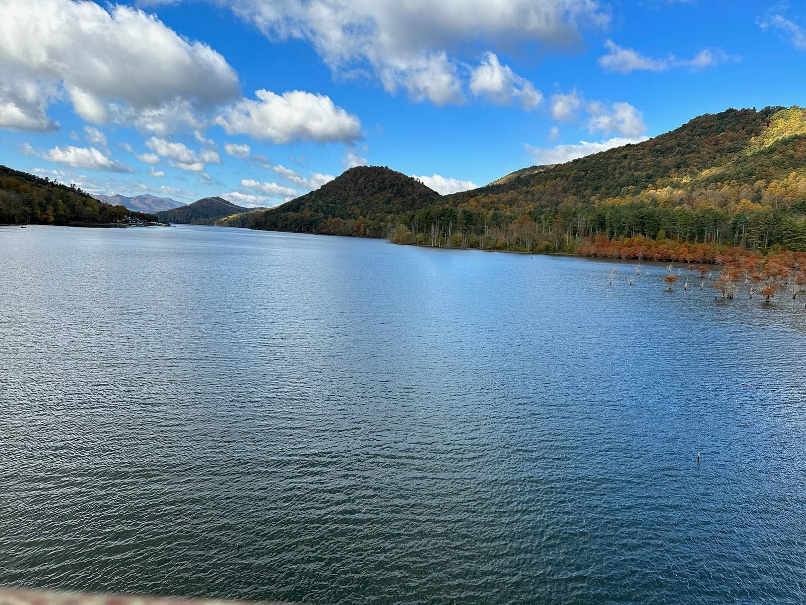
You cross into Tennessee about forty-five minutes past Boone. Hampton is the first real settlement on the TN side. Watauga Lake opens up to your right. If you’re staying at our townhouse, you’re another fifteen minutes from here.
From Atlanta
Roughly five hours from the I-285 perimeter, six from anywhere south of downtown. The drive earns its time — most of it is highway, and the scenery improves in proportion to your distance from Atlanta.
The clean route: I-85 north to Greenville, SC. Take I-26 east through Hendersonville and up the escarpment into the Asheville area. Stay on I-26 to Mars Hill / Sams Gap, where you cross into Tennessee. Continue on I-26 to Erwin, TN, then exit onto US-19W north or take TN-81 / TN-352 connectors to US-321 north through Elizabethton and into the lake area.
The shorter-looking route on the map — I-85 to I-985 to US-23 to US-441 through Cherokee — looks faster and isn’t. The roads are slower, the towns more frequent, the elevation changes more dramatic. Save it for the return trip if you’ve never driven the Smokies; it’s pretty but it’ll cost you ninety minutes.
Worth stopping for on this route:
Hendersonville or Asheville, NC. Roughly the four-hour mark. Asheville is a major detour off I-26 but worth a meal if you have the time. Hendersonville is closer to the highway and easier in and out. Either gives you a real lunch and a leg-stretch.
Erwin, TN. A small railroad town in a beautiful river bend. There’s a Mexican restaurant near the I-26 exit that several of our guests have flagged as worth the stop. Filling station here, last reliable one before the lake.
Elizabethton, TN. The last town before the lake on this route. See our Elizabethton page. Real grocery, real pharmacy, ABC store if you want to bring wine to the rental and forgot, a Walmart that’s open late. We tell every guest coming from the south to do one supply stop here.
The last leg from Elizabethton up to the lake on US-321 is twenty-five minutes of two-lane road that climbs gradually. After Hampton you’re in the lake corridor. The road follows the lakeshore in places and the view is its own reward.
From Asheville
Roughly two hours, and the most scenic of the three approaches. Asheville is closer to Watauga Lake than most people realize, and the drive is one of the better short mountain drives in the region.
Two real routes:
Faster on the clock: I-26 east to Erwin, then US-19W or TN-81 / US-321 connector through Elizabethton. About two hours.
Shorter on the map and prettier on the eyes: US-19E north out of Asheville through Burnsville, Spruce Pine, and Roan Mountain, then descending into the lake area via TN-143 and US-321. Same two hours, give or take, but a different drive — slower roads, smaller towns, real mountain scenery the entire way.
We tell first-time visitors with daylight to take US-19E. We tell second-time visitors who are tired to take I-26.
Worth stopping for on US-19E:
Burnsville, NC. A real Appalachian town with a courthouse square, a coffee shop or two, and a few restaurants. Worth half an hour to walk around.
Roan Mountain. Either the town on the TN side or the state park (a six-mile detour up TN-143). The state park is one of the genuinely special places in this region — see our Roan Mountain State Park page. If you’re driving in June, the rhododendron bloom on the Roan Highlands is the kind of thing people plan trips around.
On the I-26 route, you’ll pass through Mars Hill (small college town, decent coffee) and Erwin (lunch options near the exit).
The last mile
This is the part most guests don’t think about until they’re doing it.
Watauga Lake’s residential roads are not the highway. The lakefront cabin lanes are narrow, often steep, and frequently gravel for the last quarter mile. The hilltop rentals — ours included — climb. Our specific driveway gains about 100 feet of elevation in a short distance. In dry weather a regular sedan handles it fine. In ice or heavy rain we recommend AWD or 4WD, and we’ve had a few guests in two-wheel-drive cars in January need a pull from the neighbors. We’ll tell you ahead of time if the forecast looks problematic and what to do.
A few practical points:
- GPS gets the last half-mile wrong sometimes. Google Maps and Apple Maps both occasionally route guests onto private roads or unmaintained tracks. We send specific directions for the last mile in our booking confirmation. Trust those over the phone.
- Cell service drops in spots. If your maps app is in the middle of giving you directions and you lose signal, the directions can stall. Download the offline map for the area before you leave home, or pull up the route on WiFi at the last gas station and let it cache.
- Trailers and big vehicles need scouting. A box truck or a 30-foot Class A motorhome can probably make our driveway but will earn the climb. Call ahead and we’ll tell you what we’ve seen.
- At night, deer. The lake corridor has real deer density. Drive the last twenty minutes ten miles under the speed limit, especially at dawn and dusk. Black bears cross too, less often.
What to time your arrival around
Whatever route you take, the goal is to arrive in daylight. The lake is beautiful at dusk but the last-mile roads are easier to read in light. If you’re getting close to dark, stop in Boone, Elizabethton, or wherever you are on the route, get a sandwich, and come the rest of the way after sunset only if you have to.
The other timing factor is groceries. The closest real supermarket is in Elizabethton on the TN side or in Boone on the NC side. If you want to cook at the rental, plan a thirty-minute shopping stop in whichever town fits your route. The Hampton convenience store and the Mercantile have basics — milk, bread, cheap beer, the usual — but they are not where you do your week’s grocery list.
We send a property-specific arrival document when you book. It covers the last-mile turn-by-turn, gate codes if any, what to expect at the door, and where to park. See our property page for what you’re driving to, and the booking page to lock in dates.
The drive is part of the trip. The lake earns it.
Want to stay at the lake?
Our modern two-bedroom townhouse has sweeping lake and mountain views, a jet tub, and a gas fire pit on the back porch.
Common questions
How long is the drive from Charlotte to Watauga Lake?
How long is the drive from Atlanta to Watauga Lake?
How long is the drive from Asheville to Watauga Lake?
Will I need an AWD vehicle?
More like this
Keep reading
Driving from Tri-Cities Airport to Watauga Lake — a real guide
Step-by-step driving directions from Tri-Cities Airport (TRI) to the townhouse on Watauga Lake. Wher
Where to stay on Watauga Lake
A practical look at where to stay around Watauga Lake — the lakefront cabins, the hilltop townhouses
Twenty-four hours at Watauga Lake
An hour-by-hour itinerary for a single overnight at Watauga Lake. What to skip, what to actually do,
Cherokee National Forest from Watauga Lake
Watauga Lake sits inside the Cherokee National Forest, which is most of why the shoreline is undeveloped and the water is so clear.